Download presentation
Presentation is loading. Please wait.

1
Multi-Focused Geospatial Analysis Using Probes

2
Traditionally, geospatial visualizations have only a single perspective

3
When you zoom out for an overview… Local anomalies become suppressed

4
When you zoom in to see details… You lose spatial awareness (“the overall picture”)
")
5
What is a Probe? Pair consisting of: - Region-of-Interest - Coordinated Visualization & Some visual connection Rendered directly within the main visualization Can be directly interacted with

6
Applications To show the benefits of using probes… three existing applications are extended: - LIDAR Change Detection (3D GIS) -Census Data Exploration Tool -Agent-Based Social Simulation
 -Census Data Exploration Tool -Agent-Based Social Simulation")
7
LIDAR Change Detection, Before

8
LIDAR Change Detection, After

9
Spatial Awareness - Examine from afar - Multiple Foci - Preserve relationships

10
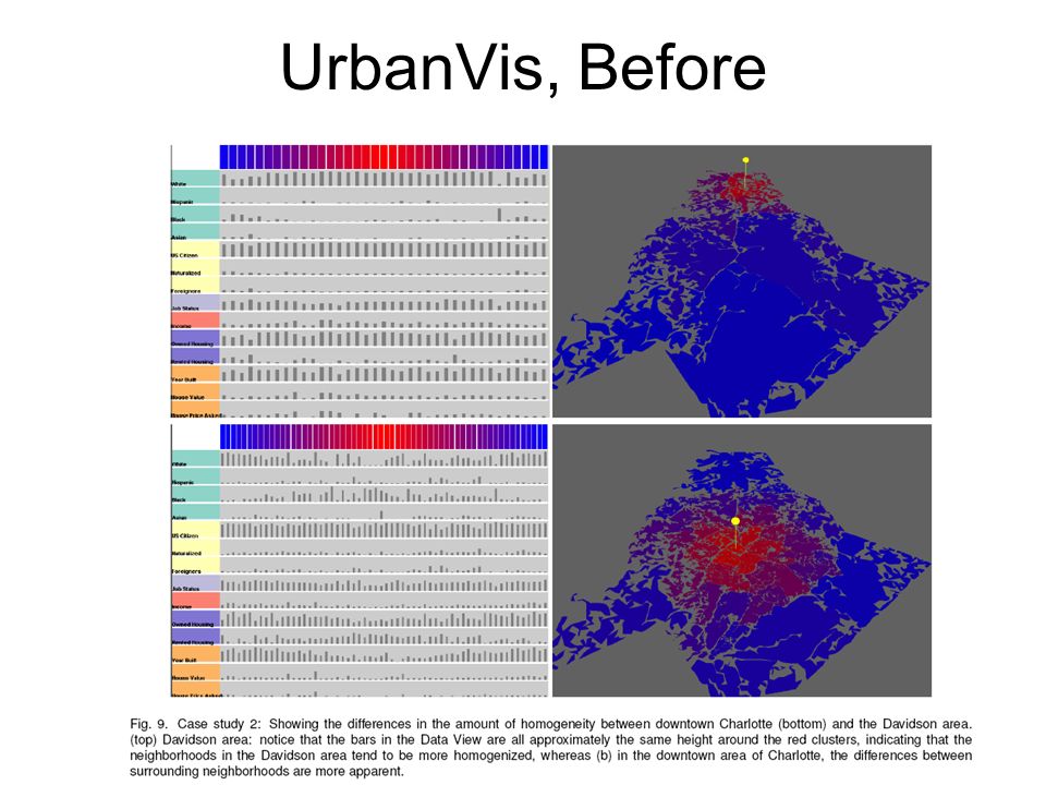
UrbanVis, Before

12
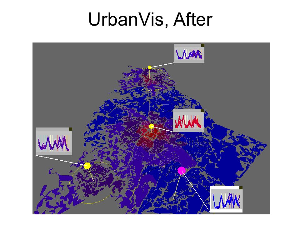
UrbanVis, After

14
Mutli-Focus Comparison - Interaction with multiple ROIs - Clear relationships - Annotation: - InfoVis panels glyphs

15
Social Simulation “Hearts & Minds” of Afghanistan population Test Social Theories Agent-Based Single Perspective: Visualization & Controls

16
“Interface on Demand”

17
Multiple instances encouraged

18
Creating a Probe Region-of-Interest: Uniform: Focal Point + Extent (Radius) Non-uniform: Manual selection (painting)
 Non-uniform: Manual selection (painting)")
19
Expandable Probe Interfaces

20
Direct Comparison

21
Local Control and Local Inspection on different ROIs

22
Complex inter-map and inter-region relationships possible

23
Collaborative Environment

24
Benefits No loss of original functionality View Independence –Zoomless Inspection Less navigation –Preserves global view –Context awareness –Simultaneous comparison of distant regions

25
Benefits Multi-Focus Inspection –Unlimited, dynamic regions-of-interest –Wide range of inspections possible at once –Direct and indirect comparison –Less cognitive memory required –Avoids change-blindness –Faster comparison

26
Benefits Location-specific Manipulation –Extends global controls to local regions –More precise interaction –No limits to scale of adjustments or controls –Collaboration is facilitated

27
Caveats Modifiable Areal Unit Problem (MAUP) –Variations in how areas are delineated can cause misleading comparisons –Stems from user definable ROIs –Add helpers to region creation? e.g. Population scale

28
Caveats Scalability –If an existing coordinated visualization requires a significant percentage of CPU time… –Multiple instances will slow application down

29
Caveats Control of Overlapping Regions –Conflicts and Collisions –Ambiguous problem –Domain specific solutions A B ?

30
Conclusions Probes… –Replace or supplement single perspectives –Extend geospatial visualizations with… View Independence Multi-Focus Inspection Location-Specific Control –Could be applied to more abstract spatial data –Remove interface clutter –Facilitate collaboration

31
Questions? tbutkie@gmail.com http://www.viscenter.uncc.edu/

Similar presentations


 Michael Gleicher “I have a bad case of Academic Attention Deficit.>")


![1 Presented by Jean-Daniel Fekete. 2 Motivation Mélange [Elmqvist 2008] Multiple Focus Regions.](/15/4851107/big_thumb.jpg "1 Presented by Jean-Daniel Fekete. 2 Motivation Mélange [Elmqvist 2008] Multiple Focus Regions.>")
 Zhang, Craig H. Ganoe,>")


 2.>")


 Peter McLachlan, Tamara Munzner Eleftherios Koutsofios, Stephen North AT&T Research Symposium August, 2007.>")


