Download presentation
Presentation is loading. Please wait.

1
Sculpting the Earth’s Surface
Glaciers, Deserts, and Wind

2
Glaciers Glaciers are a part of both the hydrologic cycle and rock cycle A thick mass of ice that originates on land from the accumulation, compaction, and recrystallization of snow

3
Glaciers Location Occupy 10% of Earth’s surface
Primarily located in polar regions (Antarctica & Greenland) But found on every continent Form above the snow line Image from
 But found on every continent. Form above the snow line. Image from")
4
Glaciers Formation New layers form each year
Weigh of overlying layers compresses buried layers Snow recrystallizes – looks like sugar Snow begins to grow, air pockets decrease compacts & becomes very dense After 2 winters => FIRN

5
Glaciers Formation (continued) Firn
Generally 16x the size of a snow crystal ½ as dense as water Increase in size as the overburden increases Over time, grows to form even larger crystals Forms glacial ice

6
Glaciers Movement When ice sheet thickness > 18 meters, the ice sheet: Deforms Flows Movement slower at base than at top Advance and retreat Surge

7
Glaciers Types of glacial movements Plastic flow Basal slip

8
Glaciers Rates of movement Average velocities vary considerably
Rates of up to several meters per day Some glaciers exhibit extremely rapid movements called surges

9
Glaciers Movement (continued) Budget of a glacier
Accumulation + loss = glacial budget

10
If accumulation exceeds loss (called ablation), the glacial front advances
, the glacial front advances")
11
If ablation increases and/or accumulation decreases, the ice front will retreat

12
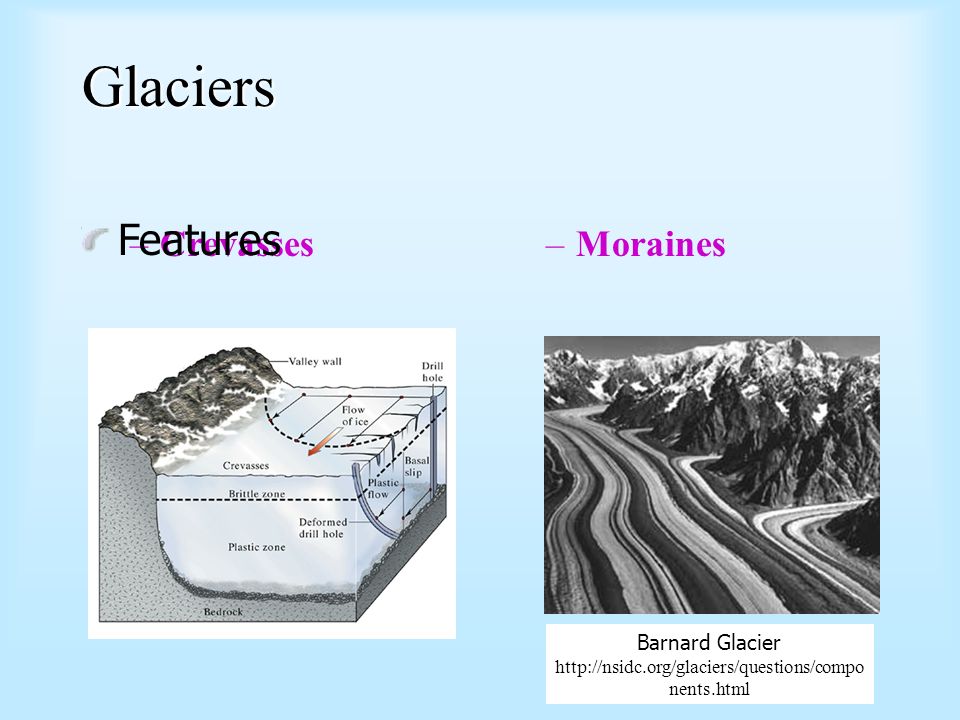
Glaciers Features Crevasses Moraines Barnard Glacier
14
Glaciers Types Glaciers Ice Mountain Glaciers, Ice Sheets,
Valley Glaciers, Piedmont Glaciers, Cirque Glaciers, Hanging Glaciers, Tidewater Glaciers. Ice Ice Sheets, Ice Shelves, Ice Caps, Ice Streams, and Ice fields

15
Types of Glaciers

16
Glaciers Glaciers erode by Plucking – lifting of rock blocks Abrasion
Rock flour (pulverized rock) Striations (grooves in the bedrock)
 Striations (grooves in the bedrock)")
18
Glaciers Landforms created by glacial erosion Glacial Valleys Fjords
Pater noster lakes Cirques Tarns Arêtes Horns

19
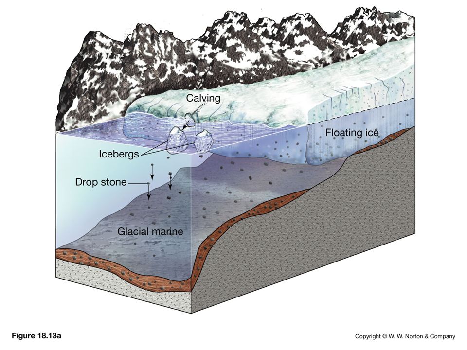
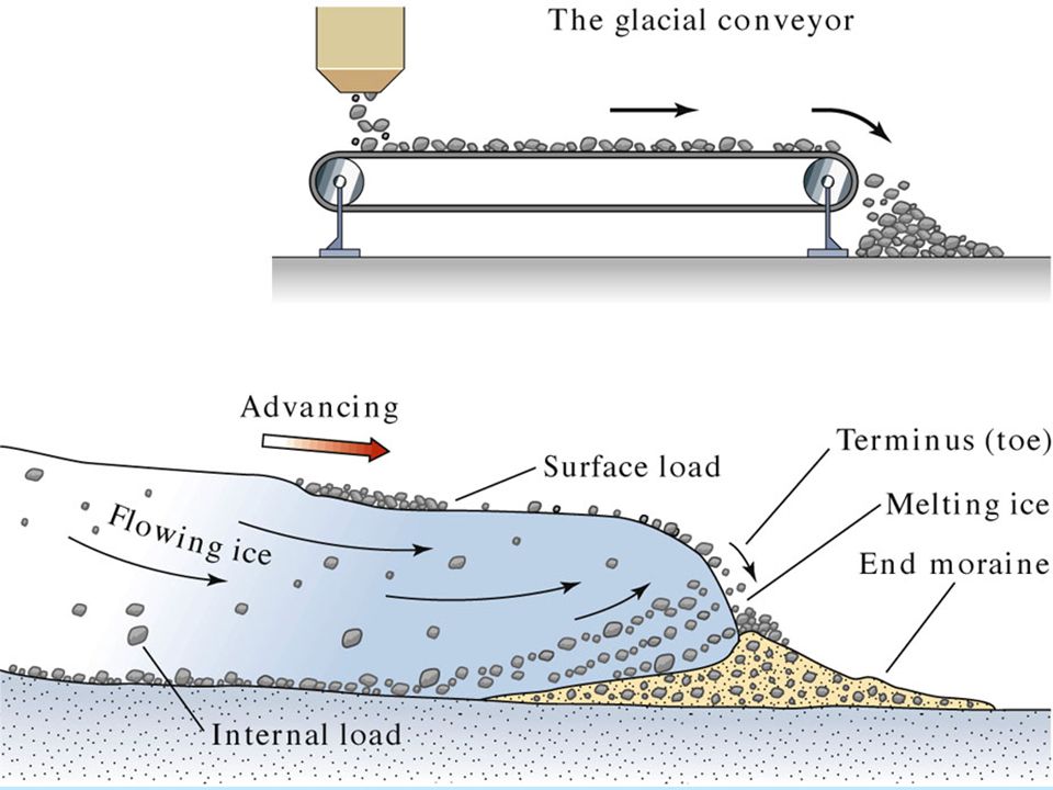
Glaciers Glacial deposits Glacial drift
All sediments of glacial origin Types of glacial drift Till – material that is deposited directly by ice Stratified drift - sediment deposited by meltwater

20
Glaciers Glacial deposits Depositional features
Moraines – layers or ridges of till Types of moraines Lateral Medial End Ground

21
Glaciers Glacial deposits Depositional features
Outwash plain, or valley train Kettles Drumlins Eskers Kames

22
Glacial depositional features

23
Glaciers Ice Ages Have occurred throughout Earth’s history

24
Glaciers Ice Age Began 2 to 3 million years ago
Division of geological time is called the Pleistocene epoch Ice covered 30% of Earth's land area

25
Glaciers Indirect effects of Ice Age glaciers
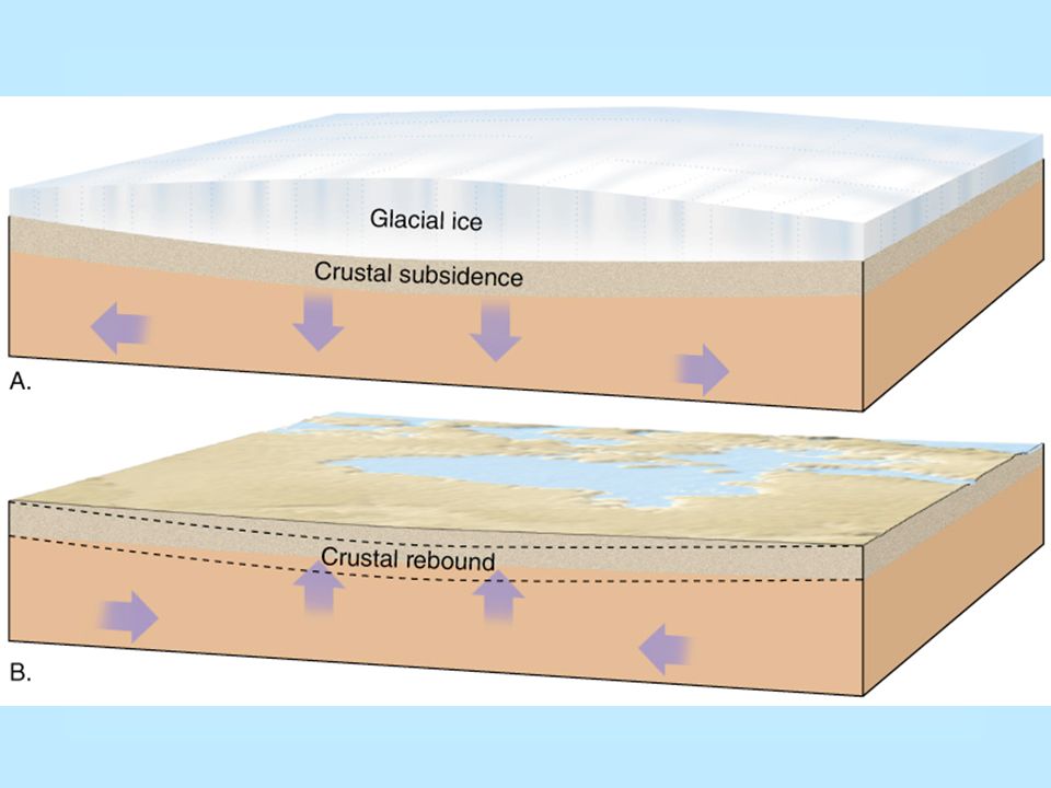
Migration of animals and plants Rebounding upward of the crust Worldwide change in sea level Climatic changes

27
Glaciers Causes of glaciation Successful theory must account for
Cooling of Earth, as well as Short-term climatic changes

28
Glaciers Causes of glaciation Proposed possible causes Plate tectonics
Continents were arranged differently Changes in oceanic circulation (Thermohaline Current)
")
29
Glaciers Causes of glaciation Proposed possible causes
Variations in Earth's orbit The Milankovitch hypothesis Shape (eccentricity) of Earth’s orbit varies Angle of Earth’s axis (obliquity) changes Earth’s axis wobbles (precession)
 of Earth’s orbit varies. Angle of Earth’s axis (obliquity) changes. Earth’s axis wobbles (precession)")
30
Desert Definition : A region so arid that it contains no permanent streams except for those that bring water in from elsewhere, and has very sparse vegetation cover. NOT related to temperature! Deserts can be Hot (>35 °C) Cold (< 20 °C)
 Cold (< 20 °C)")
31
Desert Location Dry regions cover 30% of Earth’s land surface

32
Desert Types of deserts Two climatic types are commonly recognized
Desert or arid Steppe or semiarid

33
Deserts Types of deserts
Classified by environment in which they are formed subtropical: in the hot dry latitudes between 20 and 30°, both north and south rain shadow: on the landward side of coastal mountain ranges coastal: along coasts bordering cold ocean currents continental interior: deep within continents, far from major water sources polar: in the cold dry polar regions, both north and south

34
Location of Deserts

35
Earth’s dry regions coincide with the subtropical high pressure belts & solar heating

36
Deserts Weathering and Erosion Not as effective as in humid regions
Mechanical weathering forms unaltered rock and mineral fragments Some chemical weathering does occur Clay forms Thin soil forms

37
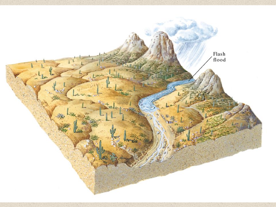
Deserts Weathering and Erosion Water Erosion Desert rainfall
Rain often occurs as heavy showers Causes flash floods Poorly integrated drainage Most erosional work in a desert is done by running water

39
Deserts Weathering and Erosion Water Erosion
Streams are dry most of the time Desert streams are said to be ephemeral Flow only during periods of rainfall Different names are used for desert streams including wash, arroyo, wadi, donga, and nullah

40
A dry stream channel in the desert

41
The same stream channel following heavy rainfall

42
Deserts Weathering & Erosion Wind erosion
Differs from that of running water in two ways Wind is less capable of picking up and transporting coarse materials Wind is not confined to channels and can spread sediment over large areas

43
Deserts Weathering & Erosion Wind erosion Mechanisms of transport
Bedload Saltation – skipping and bouncing along the surface Suspended load In the air as duststorms

44
Deserts Weathering & Erosion Wind erosion Mechanisms of wind erosion
Deflation Lifting of loose material Produces Blowouts & Desert pavement

45
Deserts Weathering & Erosion Wind erosion Mechanisms of wind erosion
Abrasion Produces ventifacts (stones with flat faces) and yardangs (wind sculpted ridges) Limited in vertical extent
 and yardangs (wind sculpted ridges) Limited in vertical extent.")
46
Deserts Depositional Environments Water Deposits Talus Aprons
Alluvial Fans Bajada Playas and Salt Lakes

47
Deserts Depositional Environments Wind deposits Dunes
Mounds or ridges of sand Often asymmetrically shaped Characteristic features Slip face Cross beds

48
Types of Sand Dunes

49
Deserts Depositional Environments Wind deposits Loess
Deposits of windblown silt Extensive blanket deposits Primary sources are deserts and glacial stratified drift

50
Deserts Basin and Range: the evolution of a desert landscape
Uplifted crustal blocks Interior drainage into basins produces Alluvial fans and bajadas Playas and playa lakes

51
Deserts Basin and Range: the evolution of a desert landscape
Erosion of mountain mass causes local relief to continually diminish Eventually mountains are reduced to a few large bedrock knobs called inselbergs projecting above a sediment filled basin

52
Landscape evolution in a mountainous desert – early stage

53
Landscape evolution in a mountainous desert – middle stage

54
Landscape evolution in a mountainous desert – late stage

55
Inselbergs in Southern California

56
~ End ~

Similar presentations


 glaciers –>")


Types of glaciers 2)Glacier formation, movement 3)Glacial erosion 4)Glacial landforms and deposits 5)Side effects 6)Ice ages.>")


