Download presentation
Presentation is loading. Please wait.

1
GI Learner: Developing a learning line on GIScience in education Luc Zwartjes Ghent University, geography department Sint-Lodewijkscollege Brugge EUROGEO

2
GI Science spatial thinking

3
A spatially literate student has following characteristics Habbit of mind of thinking spatially – knows where, when, how and why to think spatially Practice spatial thinking in an informal way – deep and broad knowledge of spatial concepts and representation… Adopt critical stance to spatial thinking – evaluate quality of spatial data, use spatial data to construct … http://www.nap.edu/catalog.php?record_id=11019

4
Spatial thinking is even more … geospatial thinking Spatial thinking traditionally linked to spatial visualization and orientation, to spatial perception and mental rotation as integration in spatial visualization

5
Spatial thinking is even more … geospatial thinking Spatial thinking traditionally linked to spatial visualization and orientation, to spatial perception and mental rotation as integration in spatial visualization Geospatial: not only to do with visualization and relationships, it means to manipulate (e.g. using simulations), interpret and explain information at different geographic scales connected to Earth.
, interpret and explain information at different geographic scales connected to Earth..")
6
Spatial thinking is even more … geospatial thinking The ability to study the characteristics and the interconnected processes of nature and human impact in time and at appropriate scale (Kerski 2008) not a single ability but comprised of a collection of different skills (Bednarz & Lee, 2011) Geographic skills provide necessary tools and techniques to think spatially. They enable to observe patterns, associations, and spatial order (National geography standard, 2012) A solid foundation in spatial literacy will provide students with the crucial scientific and social questions of the 21st century (Tsou and Yanow, 2010).
 A solid foundation in spatial literacy will provide students with the crucial scientific and social questions of the 21st century (Tsou and Yanow, 2010)..")
7
There is an epistemological change in Geographical discipline into a new scientific praxis: a geotechnological paradigm defined as a new way of doing science possible not only derived from the technological advance, but also because of the huge increased in spatial data (big data, mining data and crowdsourcing data, among others) available to citizens whose knowledge on quality data now appears as essential (Kerski, 2015). Linking geospatial thinking to the use of GIS

8
geotechnological paradigm a proper use of technologies, which in Geography can be translated into using technologies and GIS as a science not only as a tool (teaching GIS) but for learning, teaching and researching: teaching with GIS (Koutsopoulos, 2010). Linking geospatial thinking to the use of GIS

9
But how to implement? Four schools of thought about the relationship between geography & GIS (Kemp. et al, mentioned by Sui, 1995

10
But how to implement? Five ways of integrating GIS in geography education (Favier, 2013)
")
11
In teacher training GIS is not a core item. Non-geographers, leading to teachers with limited pedagogical content knowledge, resulting in fewer teachers recognizing the potential opportunities GIS offers to teach geography content and skills, teach more and more geography. Curriculum doesn’t include or impede adoption to include GIS. The non-availability of free data and easy-to-use software. The attitude of teachers. It seems difficult to persuade teachers to use new technologies, certainly if they are highly technical demanding and if teachers are not fully convinced of the effectiveness and added value. Why not used more / better? Bednarz and van der Schee (2006)
.")
12
In teacher training GIS is not a core item. Non-geographers, leading to teachers with limited pedagogical content knowledge, resulting in fewer teachers recognizing the potential opportunities GIS offers to teach geography content and skills, teach more and more geography. Curriculum doesn’t include or impede adoption to include GIS. The non-availability of free data and easy-to-use software. The attitude of teachers. It seems difficult to persuade teachers to use new technologies, certainly if they are highly technical demanding and if teachers are not fully convinced of the effectiveness and added value. Why not used more / better? Bednarz and van der Schee (2006)
.")
13
iGuess www.iguess.euwww.iguess.eu I-Use www.i-use.euwww.i-use.eu EduGIS www.edugis.nl, www.edugis.plwww.edugis.nlwww.edugis.pl Geospatial Semester http://www.isat.jmu.edu/geospatialsemester http://www.isat.jmu.edu/geospatialsemester PaikkaOppi learning environment http://www.paikkaoppi.fi/ http://www.paikkaoppi.fi/ But not structured Already many ideas/materials

15
Aim Creating a learning line “educational term that refers to the construction of knowledge and skills throughout the whole curriculum. This learning line reflects an increasing level of complexity, ranging from easy (more basic skills and knowledge) to difficult.”
 to difficult. .")
16
Aim 5 learning lines: FieldworkWorking with images Working with maps Working with statistical material Creation of knowledg Level 1Perception – knowledge of facts Level 2Analysis – selection of relevant geographic information Level 3Structure – look for complex connections and relationships Level 4Apply – thinking problem solving

17
Different steps 1.Summarize the most important literature on learning lines and spatial thinking - thus being the basis for the next steps. 2.Scan the curricula to identify opportunities to introduce GIScience will be used to develop all materials 3.Test to analyse the impact of the learning lines on spatial thinking 1.at the start of the project to establish the zero level, baseline value of their spatial thinking capability. 2.At the end of each year the test will be done again, thus offering the opportunity to measure the impact of the developing learning line and to adjust if needed.

18
Different steps 4.create the first drafts of learning line, translating them into real learning objectives for selected years (K7 and K10) - taking into account the subjects of the curricual in their country 4.each year a part of the total learning line will be elaborated. 5.Include necessary classroom materials, 5.In the first year of the project, pupils of different ages (K7 and K10) of the partner schools will test the materials and give their feedback and if appropriate their amendements. 6.The teachers and researchers will rewrite the learning outcomes into a final version.
 of the partner schools will test the materials and give their feedback and if appropriate their amendements. 6.The teachers and researchers will rewrite the learning outcomes into a final version..")
19
Different steps 7.In the second and third year of the project the same activities will be done for year groups K8-K11 and K9- K12.- same group of pupils will be testing the materials for three years in a row 8.The final learning lines will be published. along with the essential classroom materials, thus facilitating the introduction and implementation. 9.A publication with amendments for inclusion into the national curricula will be produced and disseminated among the different national ministries of education..

20
Timeframe: September 2015 – August 2018 more info : www.gi-learner.eu (soon) join us at the next EUROGEO conference: September 2016 luc.zwartjes@ugent.bewww.gi-learner.eu
 join us at the next EUROGEO conference: September 2016")
21
www.eurogeography.eu/
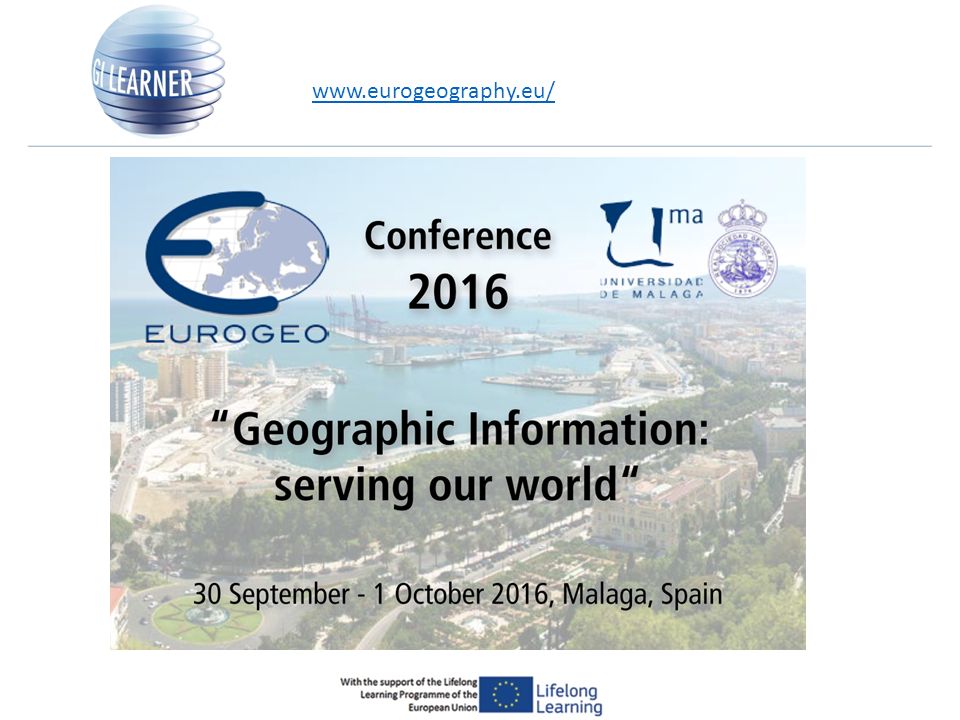
23
http://tinyurl.com/zjh2fmo

24
Timeframe: September 2015 – August 2018 more info : www.gi-learner.eu (soon) join us at the next EUROGEO conference: September 2016 http://www.eurogeography.eu/conference-2016-malaga/ luc.zwartjes@ugent.bewww.gi-learner.eu http://www.eurogeography.eu/conference-2016-malaga/
 join us at the next EUROGEO conference: September")
Similar presentations


 Ain Shams University.>")
 281-3927.>")


 has the ability to store, retrieve, manipulate and analyse a range of spatially related.>")


![This project has been funded with support from the European Commission. This publication [communication] reflects the views only of the author, and the.](/22/6371525/big_thumb.jpg "This project has been funded with support from the European Commission. This publication [communication] reflects the views only of the author, and the.>")

