Download presentation
Presentation is loading. Please wait.

1
Donaldsonville, LA to the Gulf of Mexico Feasibility Study

2
Donaldsonville, LA to the Gulf of Mexico Study Sponsors Lafourche Basin Levee District and the Louisiana Department of Transportation and Development Study Sponsors Lafourche Basin Levee District and the Louisiana Department of Transportation and Development

3
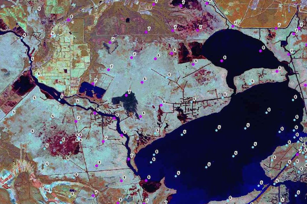
Donaldsonville, Louisiana to the Gulf of Mexico Donaldsonville, Louisiana to the Gulf of Mexico New Orleans District Boundary LakePontchartrainLakePontchartrain Gulf of Mexico Study Area Baton Rouge New Orleans Donaldsonville AlexandriaAlexandria

4
Study Objectives Hurricane Protection Hurricane Protection Interior Drainage Interior Drainage Eco-system Restoration Eco-system Restoration Corps of Engineers New Orleans District

5
Donaldsonville, LA to the Gulf of Mexico Current Levee Alignments Being Studied

6
Houma Donaldsonville Thibodaux Laplace Des Allemands Metairie GIWW Lake Salvador Lake Salvador Lake Cataouatche Lake Cataouatche Lac Des Allemands Lac Des Allemands Mississippi River Bayou Lafourche Terrebonne Parish Terrebonne Parish Lafourche Parish Jefferson Parish Jefferson Parish St. Charles Parish St. Charles Parish St. James Parish St. James Parish St. John Parish St. John Parish Larose Luling Donaldsonville, LA to the Gulf of Mexico Highway 90 Levee Alignment

7
West Bank HP Project

8
Houma Donaldsonville Thibodaux Laplace Des Allemands Metairie GIWW Lake Salvador Lake Salvador Lake Cataouatche Lake Cataouatche Lac Des Allemands Lac Des Allemands Mississippi River Bayou Lafourche Terrebonne Parish Terrebonne Parish Jefferson Parish Jefferson Parish St. Charles Parish St. Charles Parish St. James Parish St. James Parish St. John Parish St. John Parish Larose Donaldsonville, LA to the Gulf of Mexico Pipeline Canal Levee Alignment Luling Lafourche Parish

9
West Bank HP Project

10
West Bank & Vicinity, New Orleans, LA, Hurricane Protection Project West Bank & Vicinity, New Orleans, LA, Hurricane Protection Project 90 AMES P.S. OAK COVE P.S. New Orleans COUSINS P.S. LAKE CATAOUATCHE NEW WESTWEGO P.S. OLD WESTWEGO P.S. B. SEGNETTE HERO CANAL ALGIERS HARVEY CANAL ALGIERS LOCK CANAL HARVEY LOCK MISSISSIPPI RIVER ESTELLE P.S. LAKE SALVADOR Existing Pumping Stations Project Levees/Floodwalls Road Floodgate Structure MT. KENNEDY P.S. N.O. S&WB P.S. #11 SEGNETTE P.S. HARVEY P.S. 45 NEW ESTELLE P.S. HERO P.S. HERO P.S. PLANTERS P.S. PLANTERS P.S. BELLE CHASSE #2 P.S. N.O. S&WB P.S. #13 LakeCataouatcheAreaLakeCataouatcheArea EastofHarvey Canal Area EastofHarvey Westwego to Harvey Canal Area Westwego to Harvey Canal Area PLAQUEMINES P.S. 23

11
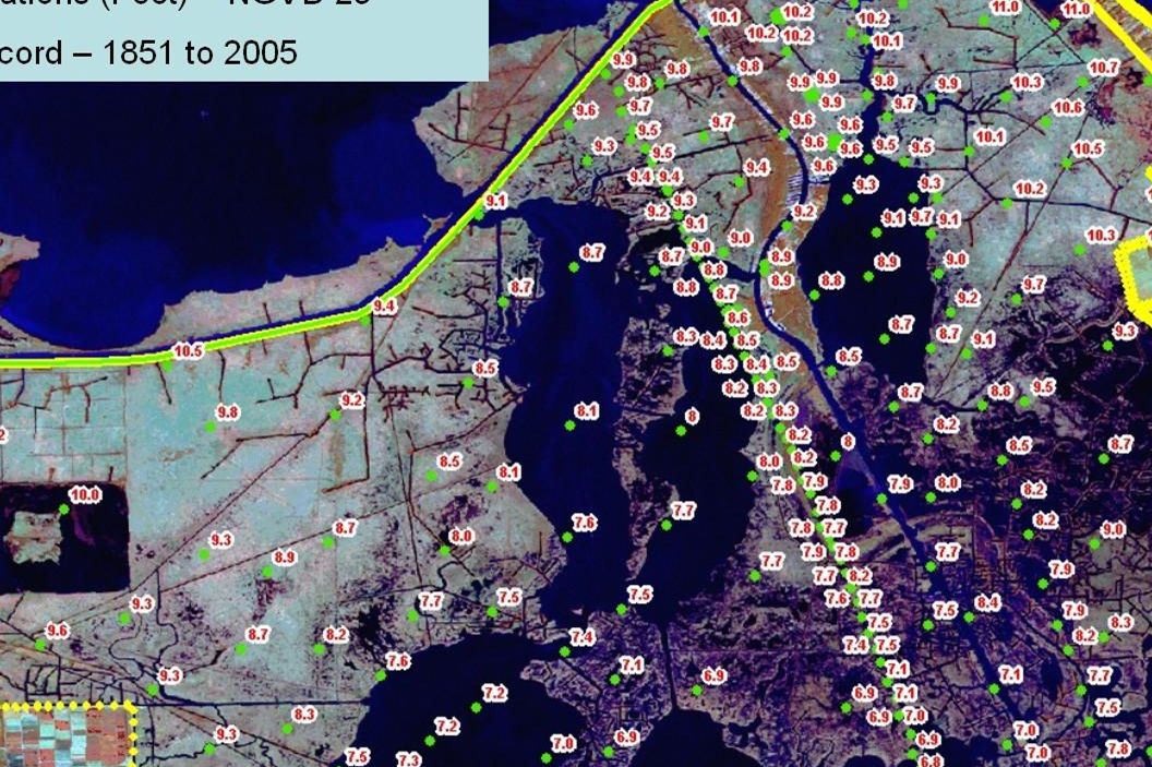
Donaldsonville, LA to the Gulf of Mexico Levee Alignment Lengths (miles) AlignmentLengthReduction Highway 90 52.9 0 Pipeline Canal 34.5 18.4 GIWW 27.2 25.7 GIWW 27.2 25.7 Modified GIWW 22.7 30.2 Modified GIWW 22.7 30.2
 AlignmentLengthReduction Highway Pipeline Canal GIWW GIWW Modified GIWW Modified GIWW")
12
West Bank HP Project

13
Donaldsonville, LA to the Gulf of Mexico Hurricane Levee Alignments

14
Donaldsonville, LA to the Gulf of Mexico Gulf Intracoastal Waterway (GIWW) Levee Alignment Advantages : Protection for the population and industries in the west bank of Miss. River up to Donaldsonville and west to Bayou Lafourche Shortest alignment (smaller front line for hurricane attack) Primary line of protection - existing levees become secondary protection. Provides vast storage area to collect rainfall, wave splashing, overtopping, or breach Reduces sharp bends, v-shapes, and pockets Optimum alignment for Cat 5 protection Fewer landowners to impact Waterway access to barge building materials and equipment, if required
 Primary line of protection - existing levees become secondary protection. Provides vast storage area to collect rainfall, wave splashing, overtopping, or breach Reduces sharp bends, v-shapes, and pockets Optimum alignment for Cat 5 protection Fewer landowners to impact Waterway access to barge building materials and equipment, if required.")
15
Donaldsonville, LA to the Gulf of Mexico Gulf Intracoastal Waterway (GIWW) Levee Alignment Disadvantages: Will require higher levee, since it is closest alignment to Gulf Will require higher levee, since it is closest alignment to Gulf Wider levees may be required in areas of weak foundation Wider levees may be required in areas of weak foundation
 Levee Alignment Disadvantages: Will require higher levee, since it is closest alignment to Gulf Will require higher levee, since it is closest alignment to Gulf Wider levees may be required in areas of weak foundation Wider levees may be required in areas of weak foundation")
18
Charles W. Nelson, P.E. Waldemar S. Nelson & co., Inc. January 24, 2006 Charles W. Nelson, P.E. Waldemar S. Nelson & co., Inc. January 24, 2006 DRAINAGE CANAL THRUSTER CONCEPTS Storm Surge Levee CL

19
Donaldsonville, LA to the Gulf of Mexico Frank Duarte Project Manager (504) 862-1014 (504) 862-2572 fax Francisco.M.Duarte@mvn02.usace.army.mil Study Website: http://www.mvn.usace.army.mil/pd/projectsList/ Below the List of Projects click on “Mississippi River & Tributaries (MRT)” click on “Donaldsonville to the Gulf of Mexico”
 (504) fax Study Website: Below the List of Projects click on Mississippi River & Tributaries (MRT) click on Donaldsonville to the Gulf of Mexico")
Similar presentations


 Environmental Assessment>")
