Download presentation
Presentation is loading. Please wait.

1
Updating Statistical maps with GPS

2
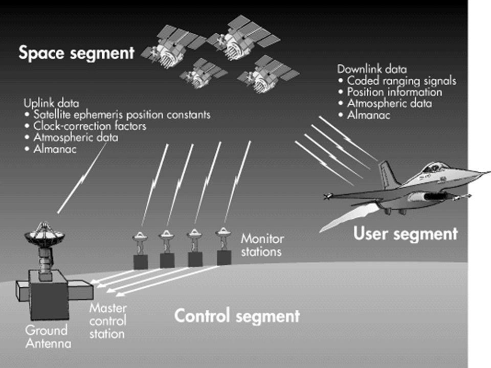
Global Positioning System Space segment Control segment Users Segment

3
GPS Satellites Name: NAVSTAR Manufacturer: Rockwell International Altitude: 10,900 nautical miles Weight: 1900 lbs (in orbit) Size:17 ft with solar panels extended Orbital Period: 12 hours Orbital Plane: 55 degrees to equatorial plane Planned Lifespan: 7.5 years Current constellation: 24 Block II production satellites Future satellites: 21 Block IIrs developed by Martin Marietta Space segment
 Size:17 ft with solar panels extended Orbital Period: 12 hours Orbital Plane: 55 degrees to equatorial plane Planned Lifespan: 7.5 years Current constellation: 24 Block II production satellites Future satellites: 21 Block IIrs developed by Martin Marietta Space segment")
5
Users Segment

7
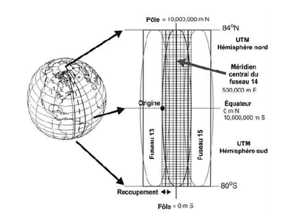
Projection

10
Errors: Atmospheric error Clock & Orbit Error Multi path Error S.A. (Selective Availability) A.S. (Anti Spoofing) DOP(Dilution Of Precision)
 A.S. (Anti Spoofing) DOP(Dilution Of Precision).")
11
Differential GPS

12
Positioning Methods: Static method Kinematic method Stop & Go method

13
Choosing suitable receiver:

14
Updating Statistical maps with GPS 1- Rural Maps (Scale 1:50000) 2-Urban Maps (scale 1:2000)
 2-Urban Maps (scale 1:2000)")
15
مرغداري حيدري Rural Maps:

16
Updating Roads:

17
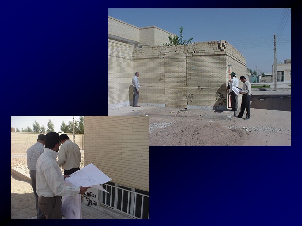
Urban Maps:

27
Problems: in the urban areas the high buildings and trees were caused cycle slip and slowness the work.

28
Result: updating the urban and rural maps of 2 provinces.

Similar presentations


 Precise positioning service.>")


. NAVSTAR Global Positioning System (GPS) Globally.>")


>")


