Download presentation
Presentation is loading. Please wait.

1
ES1 Notes Mapping

3
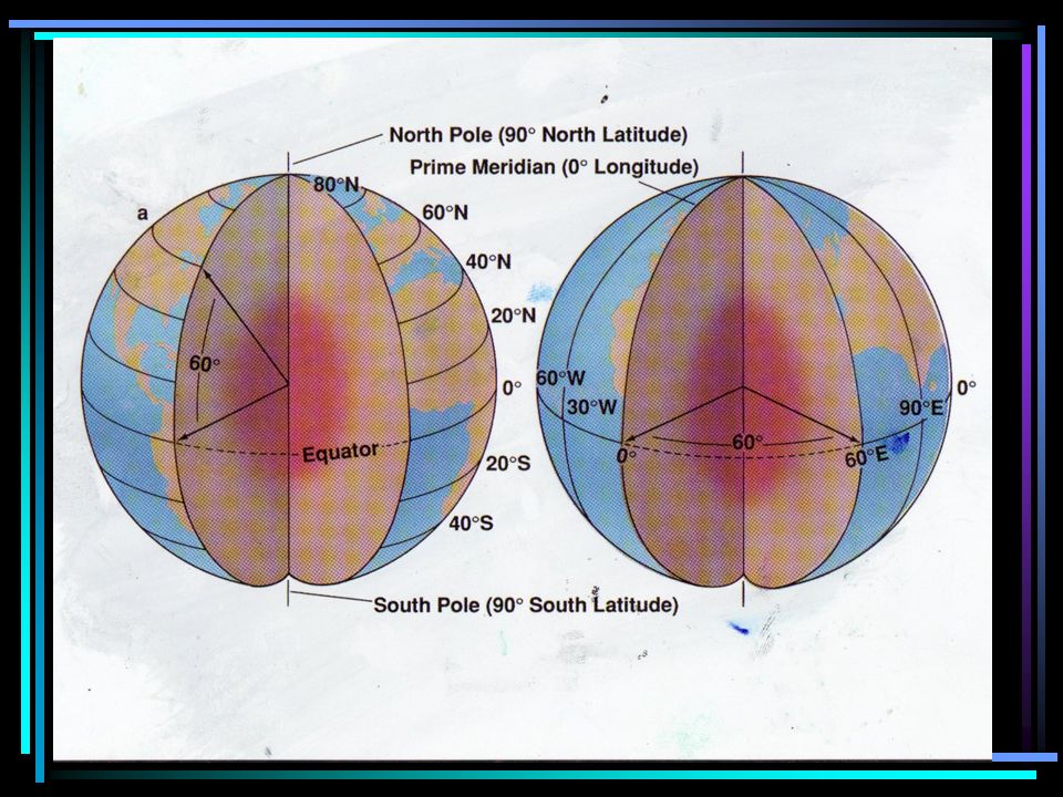
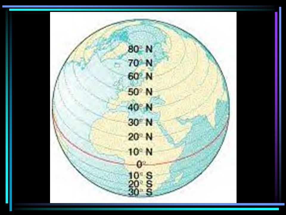
Latitude and Longitude Latitude and Longitude form a grid system used to locate points on the Earth.

4
Distances north or south of the equator are measured by ________of ___________. parallels of latitude

5
0 degrees The latitude of the equator is ______.

6
The latitude of the North Pole is ______________. 90 0 North

7
The latitude of the South Pole is ______________ 90 0 South

8
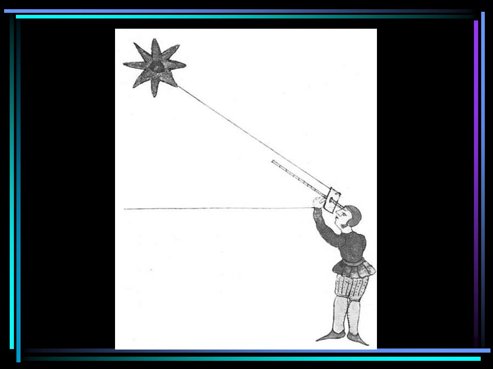
Everywhere in the Northern Hemisphere you can determine your latitude with a device called a _____. sextant

9
In order to do this you must find the star Polaris, also called the _______. North Star

10
This star is directly over head of the __________. axis of the north pole.

12
Meridians of Longitude measure distance as east or west of the Prime Meridian.

13
The longitude of the Prime Meridian is ____. 0

14
The eastern and western hemispheres meet at the ____________________. International Date Line (180 degrees)
.")
15
Any point on earth can be described by latitude and longitude coordinates. Latitude must be given first.

16
This would be incorrect:_________. 140 0 W, 25 0 N

17
This would be correct:___________. 25 0 N, 140 0 W

18
Latitude and longitude coordinates are given in degrees, ___________, and _______________. minutes and seconds

20
54 55

21
54 55 54 0 36’

22
Each degree ( o )is broken into 60 smaller pieces, each piece is called a _______. minute (, )
is broken into 60 smaller pieces, each piece is called a _______. minute (, )")
23
54 0 37 ’ 54 0 36 ’

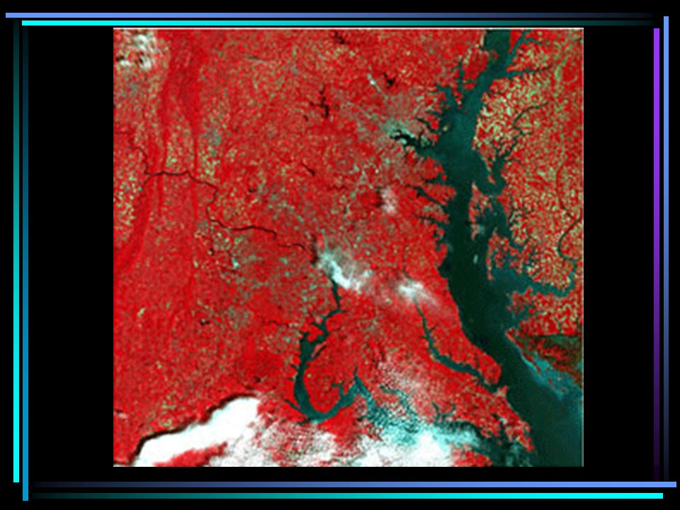
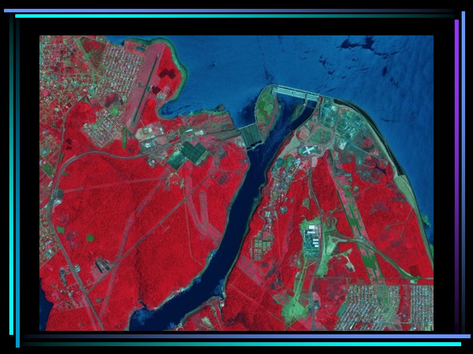
24
54 0 37 ’ 54 0 36 ’ 54 0 36’35,,

25
Each minute (, )is broken into 60 smaller pieces, each smaller piece is called a _______. second (,, )
.")
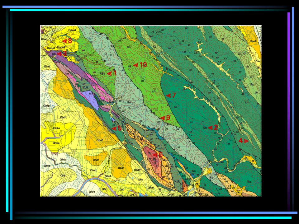
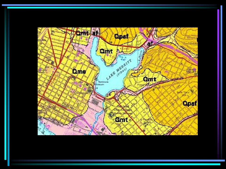
26
30 o 45’ 30’’ would read as _______. 30 degrees, 45 minutes, and 30 seconds

28
wE N S 40N, 90W

29
L60 N 30 E B40N 150W Q 30S 90E H20S 60W

30
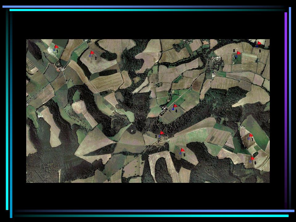
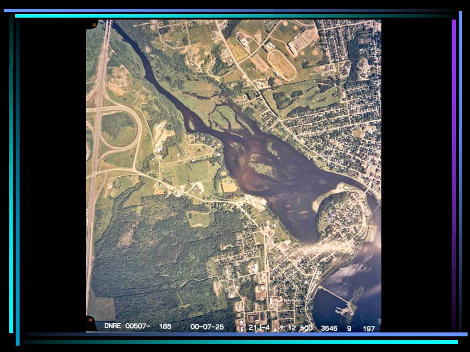
Modern Map Making Today most maps are made using ____. remote sensing (using objects that are not in direct contact with the earth)
.")
32
Methods of Remote Sensing include 1)Aerial Photographs 2)Radar Imaging 3)Sonar 4)Satellite Imaging
Aerial Photographs 2)Radar Imaging 3)Sonar 4)Satellite Imaging")
33
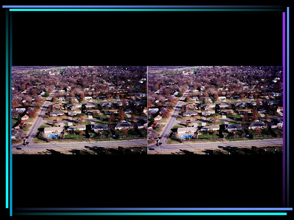
_______________ are maps. These are often used by military. Can be used to give 3D effect commonly used to update topographic maps. aerial photographs

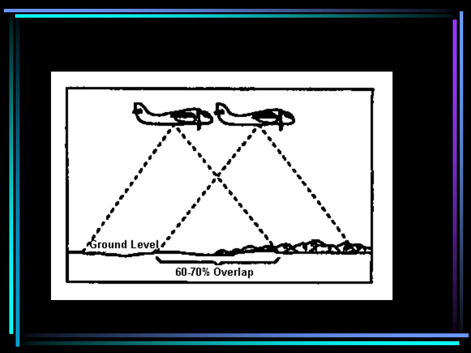
38
Airplanes fly over area and beam down _____________ that is echoed back to the plane. imaging radar

39
Advantages of imaging radar are that it can be used _________________. day or night and under any type of weather conditions.

40
Imaging Radar

41
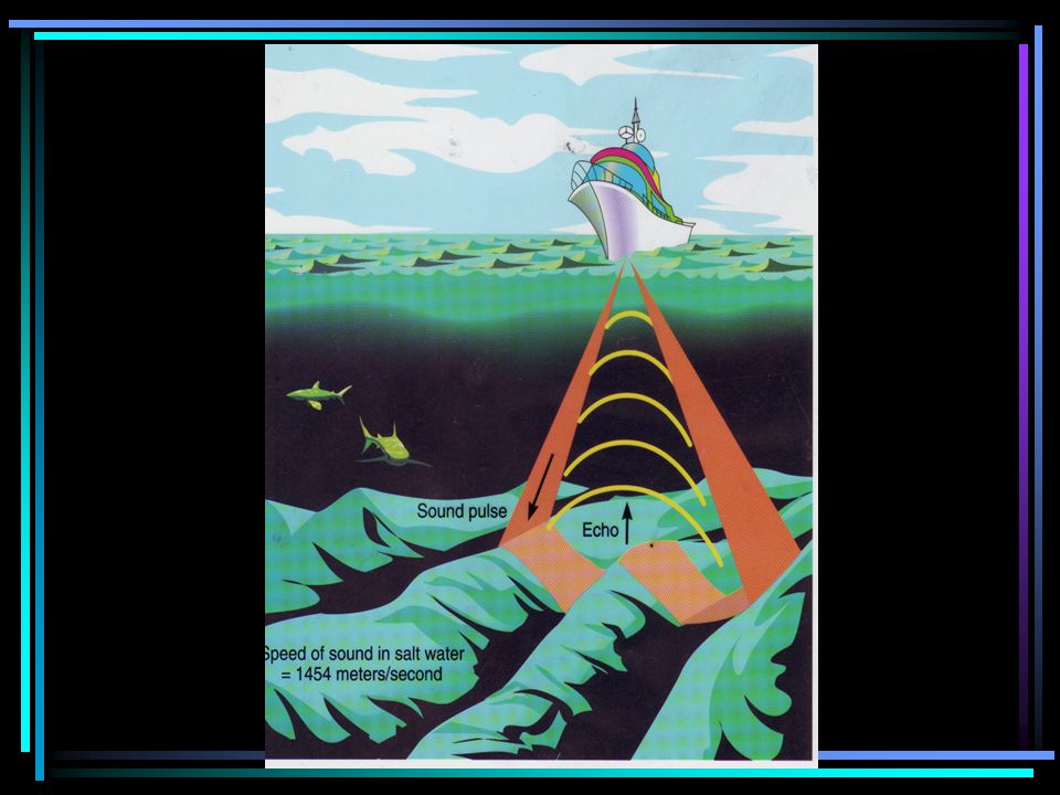
The ocean floor has been mapped using ____________. sonar (this uses sound waves)
")
44
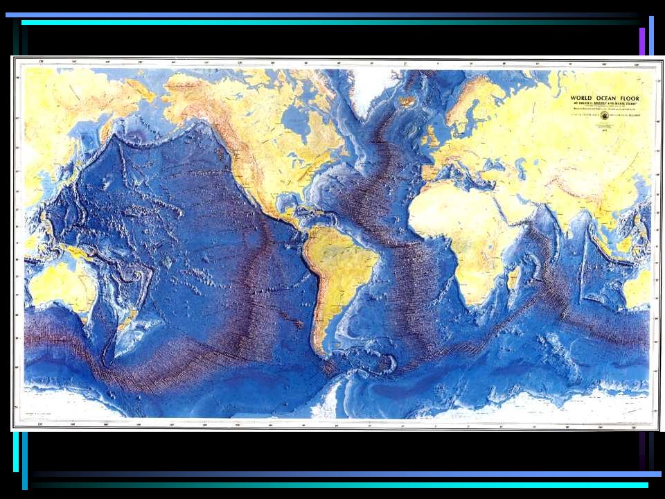
Large areas are mapped using ____. satellite images

45
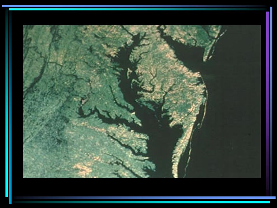
Satellite images are often given false color to more easily recognize different land features and surfaces.

49
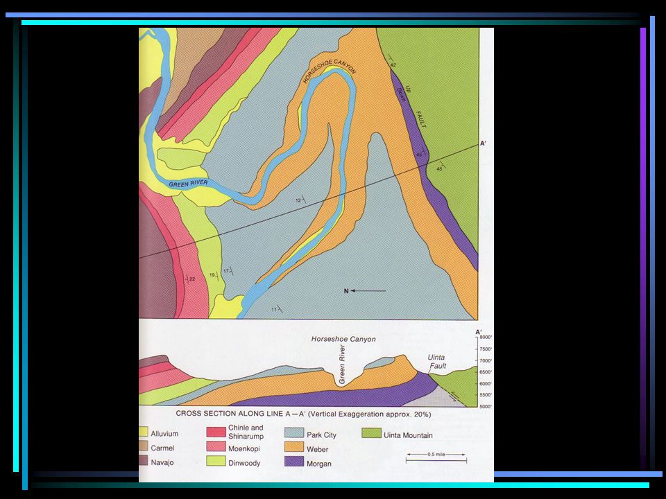
Geologic Maps and Geologic Cross sections Geologic maps show the surface rock type if layer of soil is removed.

53
ROCK TYPE SYMBOL AGE OLDEST YOUNGEST

55
Geologic Cross Section A B C D E

56
The oldest rock layer is ________. The youngest rock layer is _______. E A

58
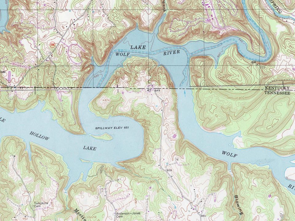
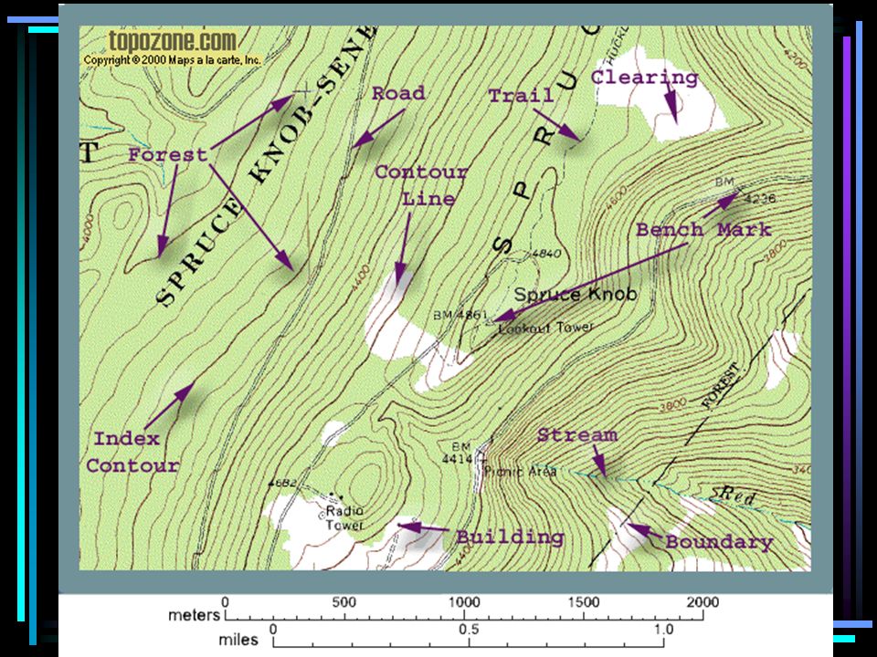
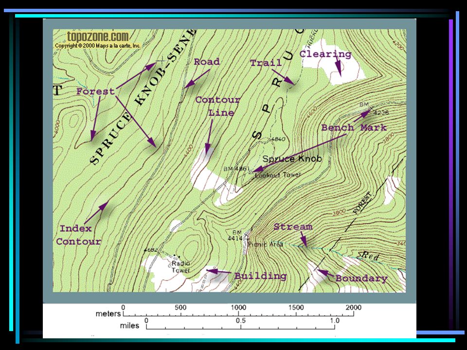
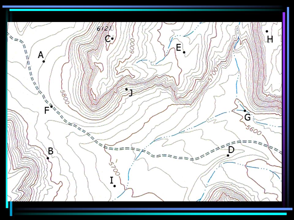
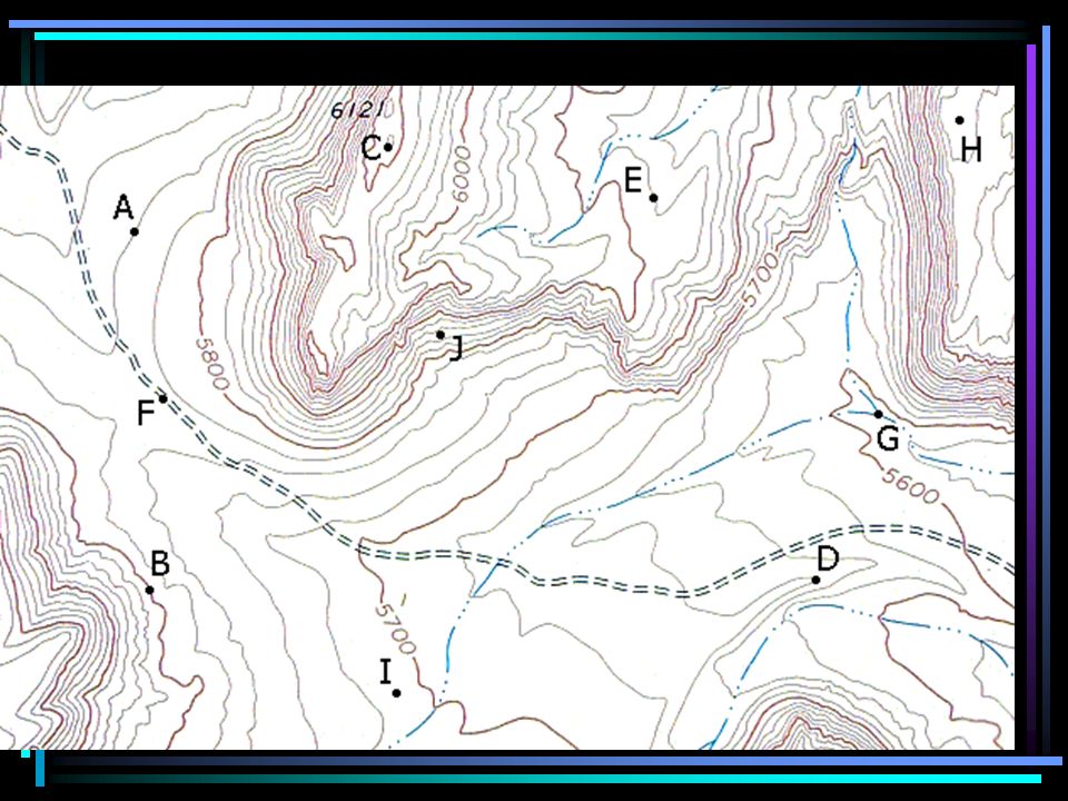
Information in a topographic maps includes _______________ roads, buildings, water bodies, landfills, rail roads, etc.

59
Topographic maps show _________ elevation. (measured in height above sea level)
")
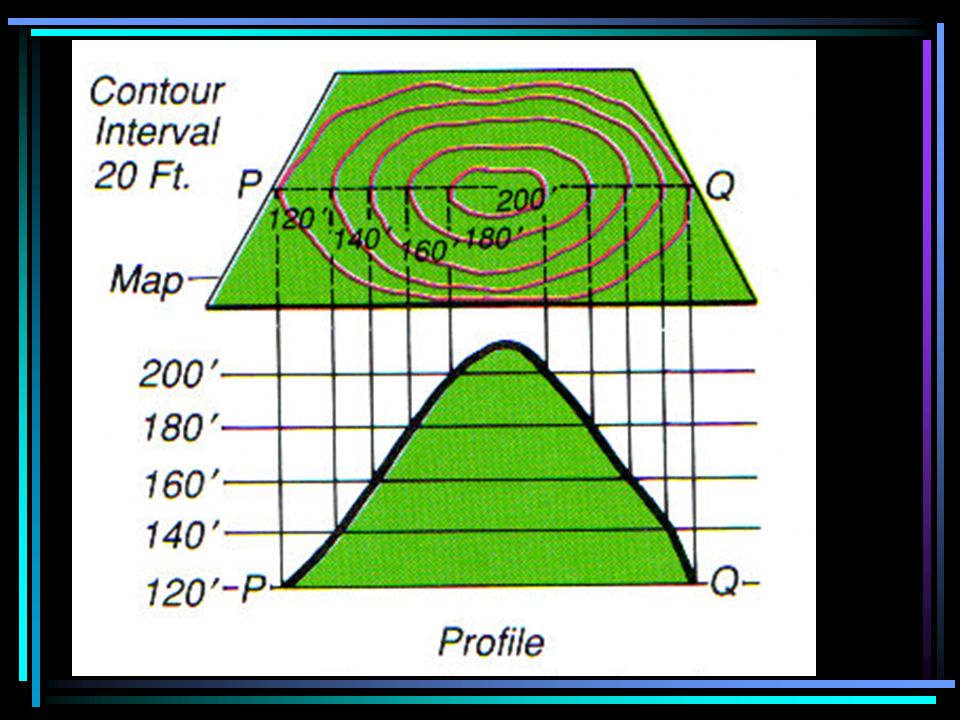
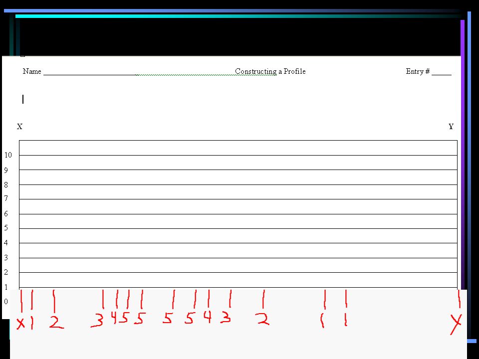
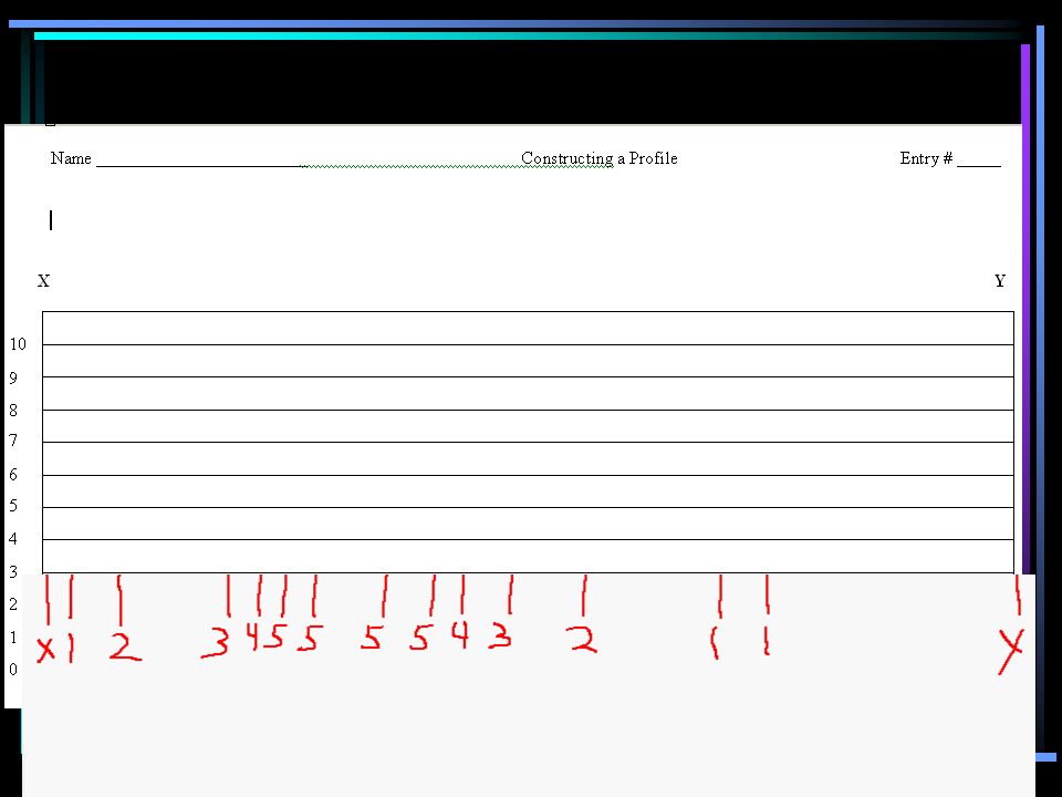
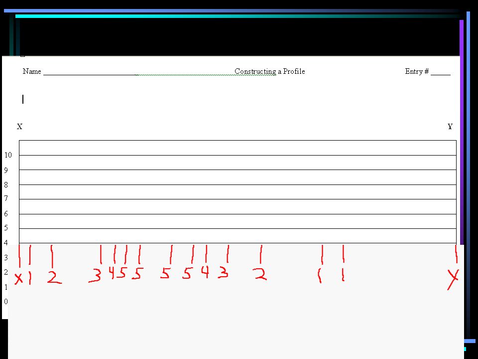
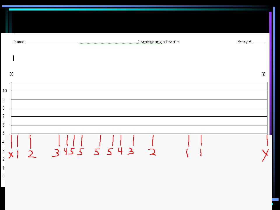
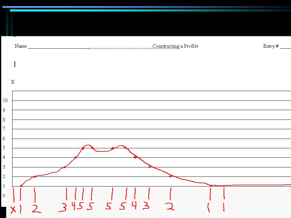
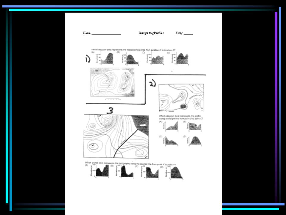
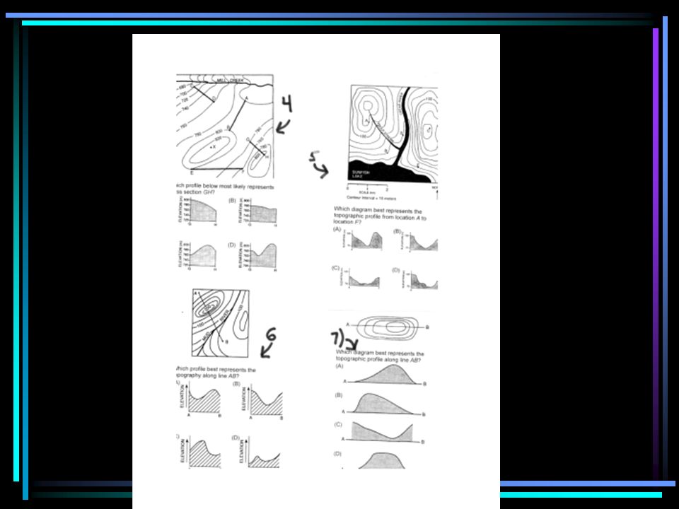
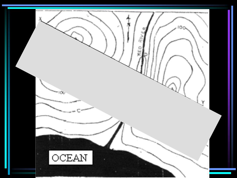
65
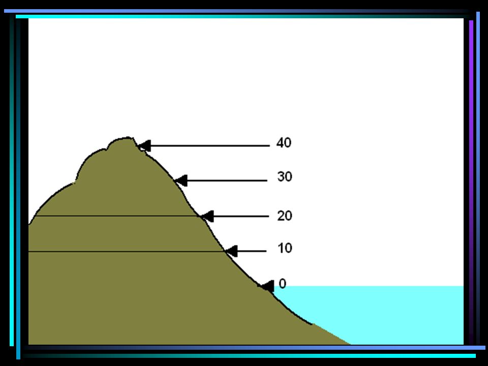
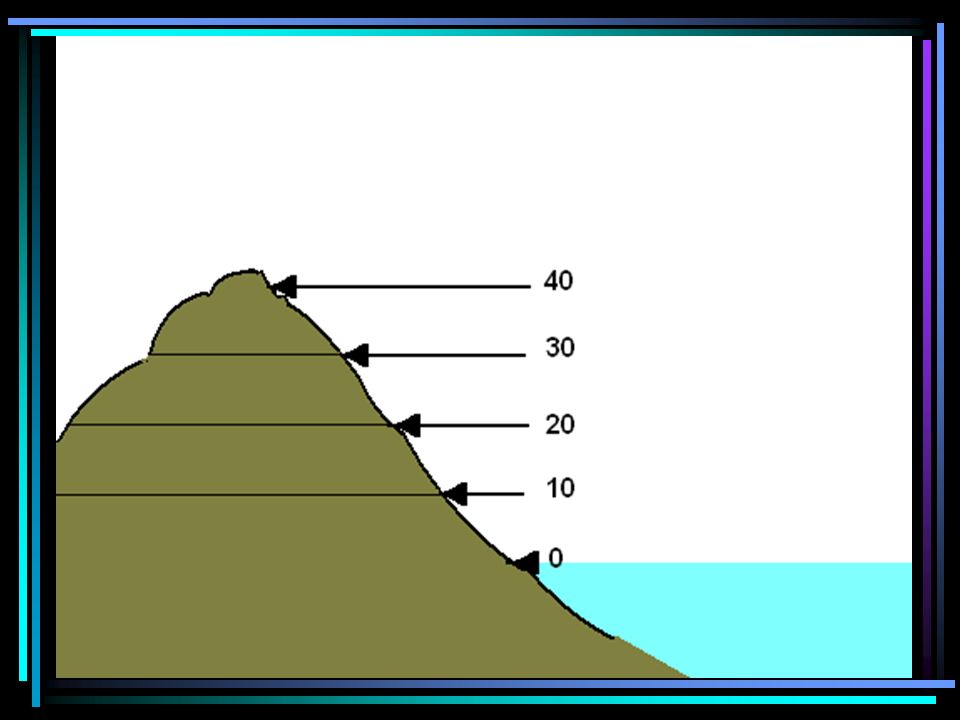
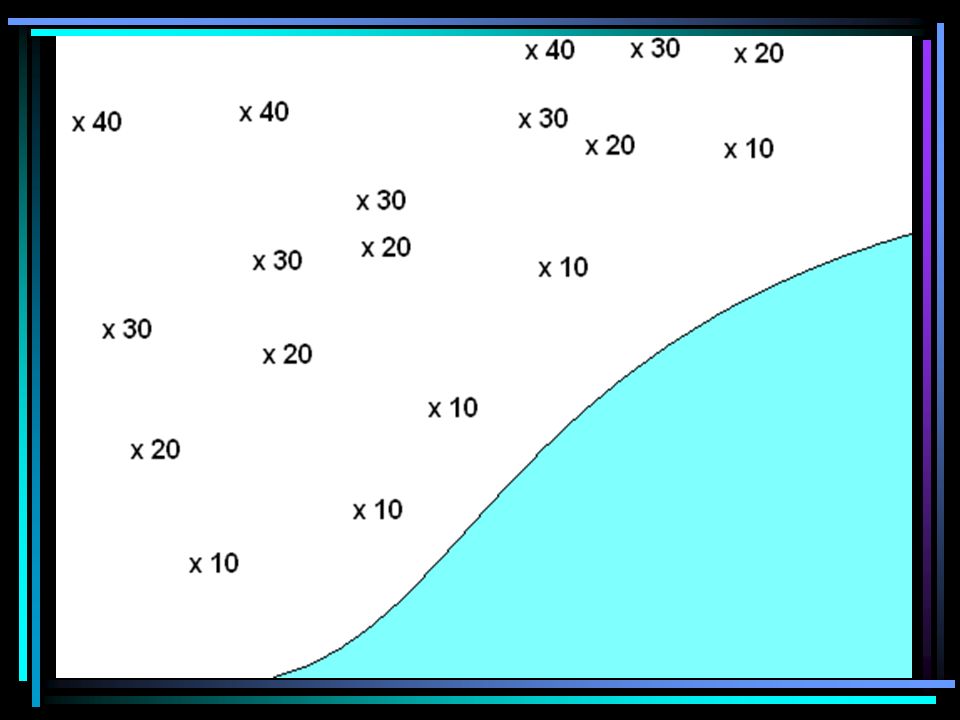
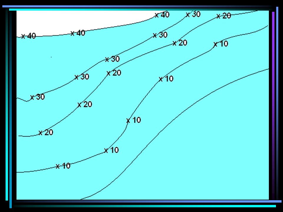
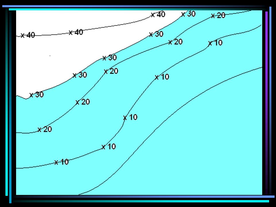
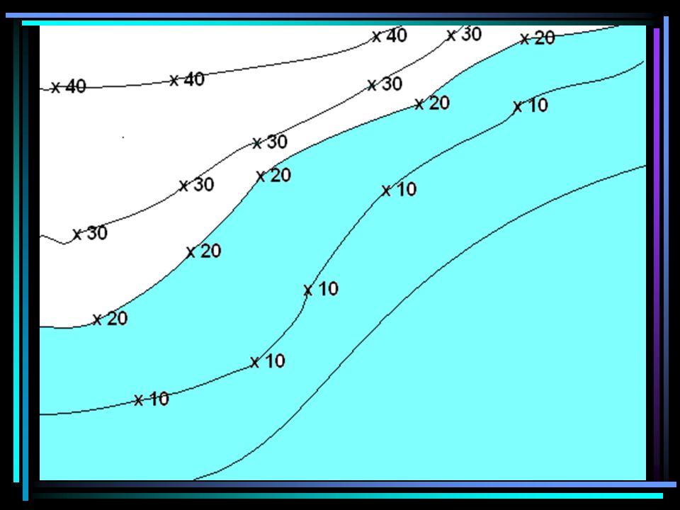
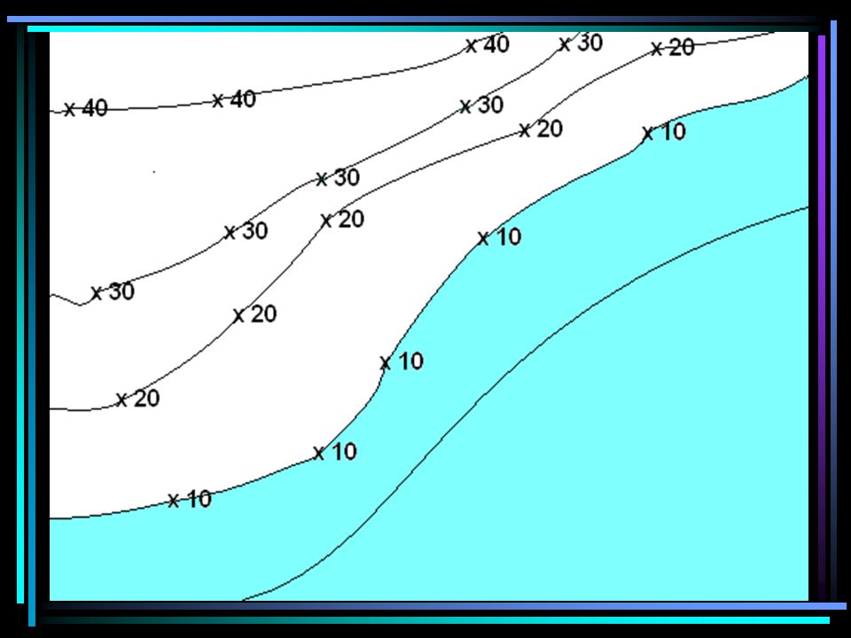
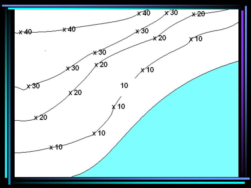
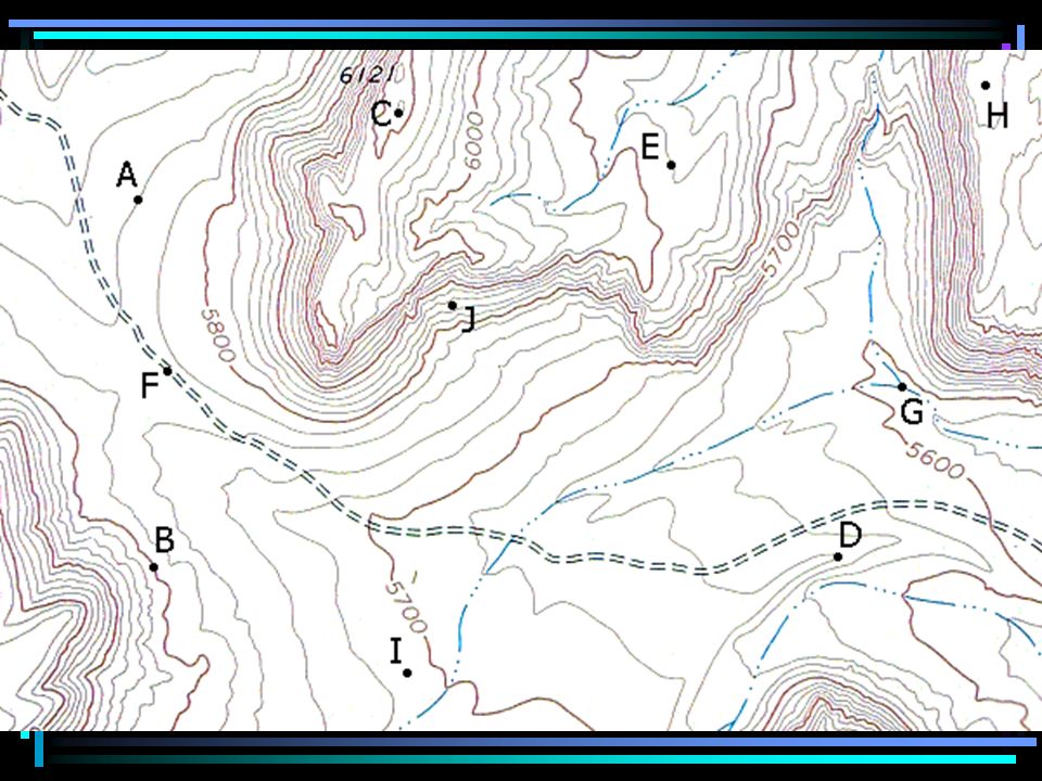
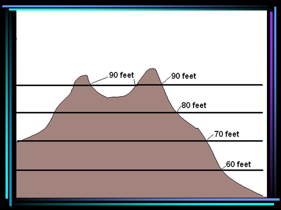
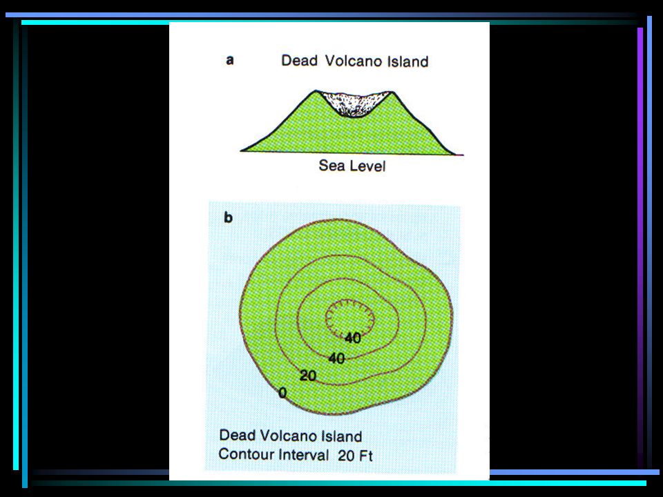
Topographic maps show elevation by the use of ________________. contour lines.

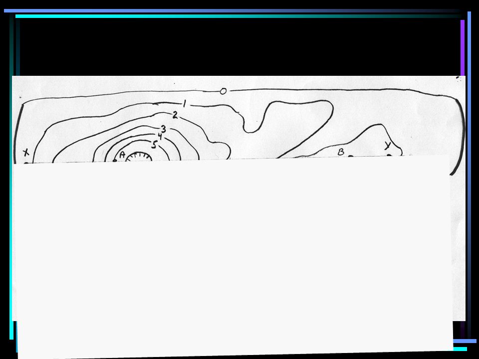
67
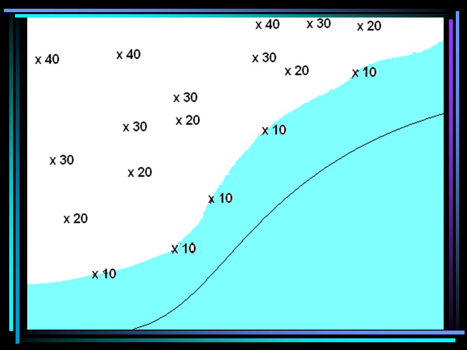
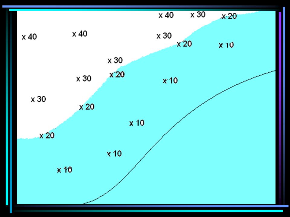
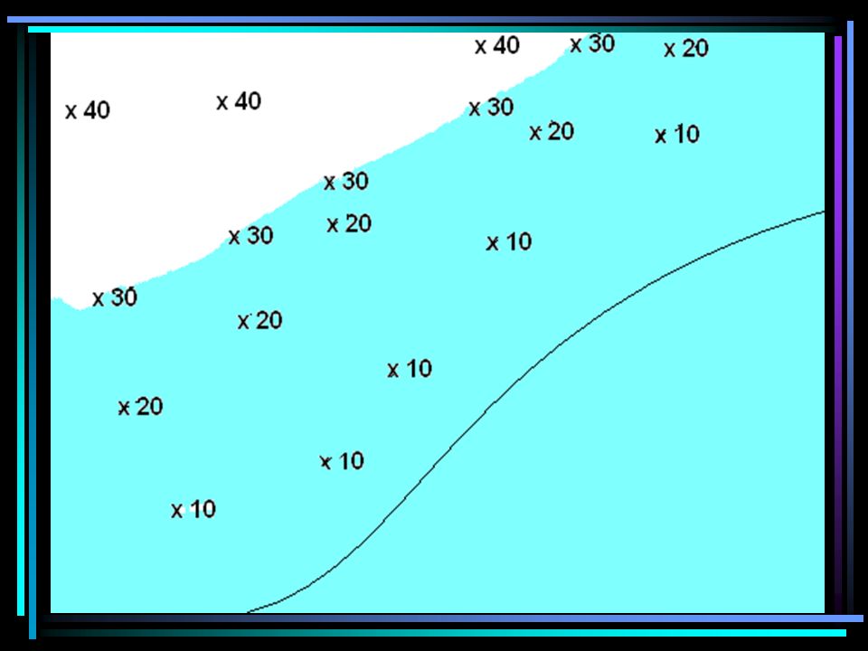
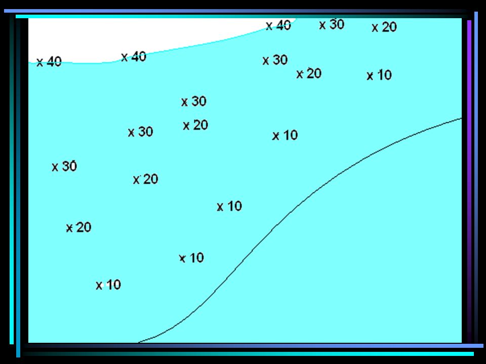
A contour line connects ________________________. points of equal elevation.

82
x12 x39

84
The difference in elevation between contour lines next to each other is known as the ________________ contour interval.

86
CI = 2

87
CI = 25

88
CI = 10

89
CI =40

90
CI = 20

91
CI = 40

92
A darkened line on a topographic map that has the elevation written on it is called an _________________. index contour.

95
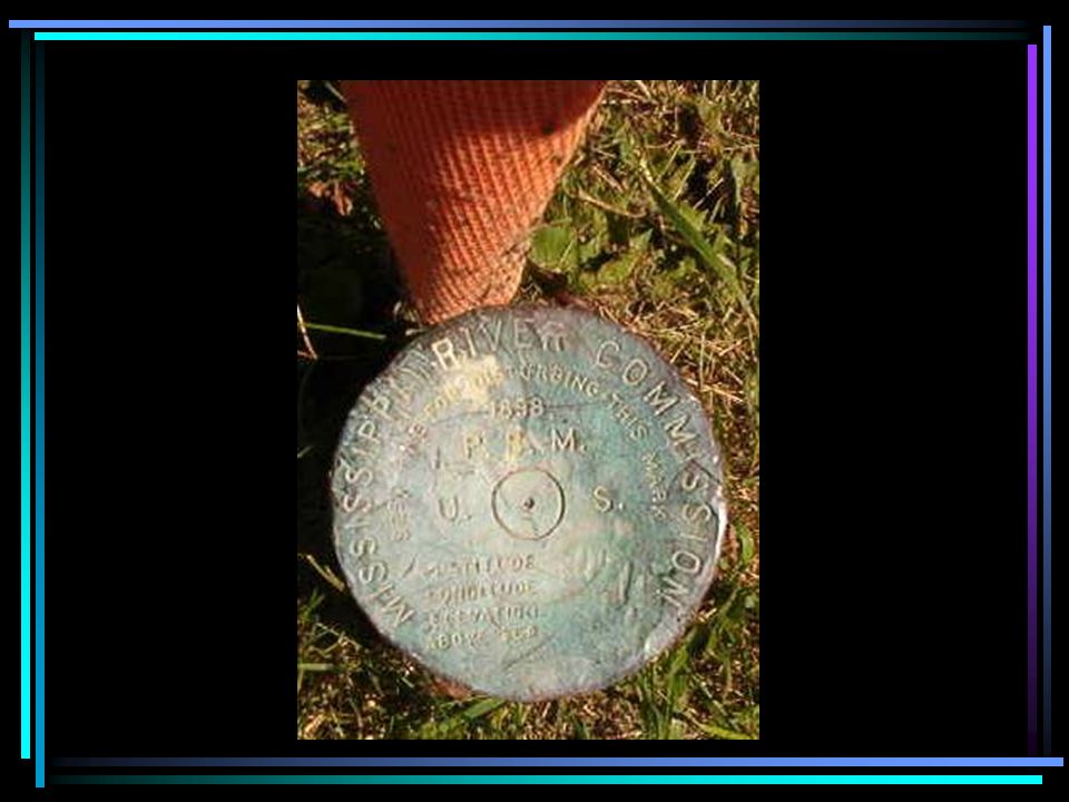
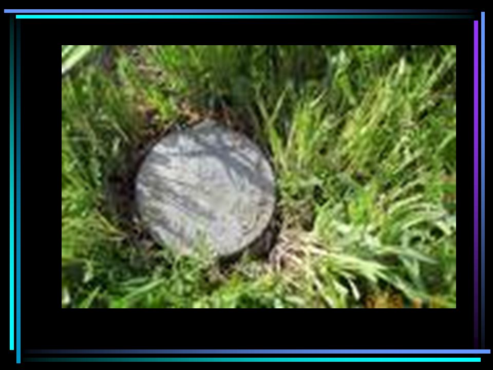
A point on a map that has the actual surveyed elevation at that point is called a ___________. benchmark.

99
There are 3 rules for using topographic maps.

100
Rule 1) ___________________. Contour lines “close” around elevations and depressions.
 ___________________. Contour lines close around elevations and depressions.")
101
X = more than 10,400 and less than 10,500

107
X = 40 Y = 20

108
2) Rule 2: ____________________ contour lines never cross or touch each other.
 Rule 2: ____________________ contour lines never cross or touch each other.")
109
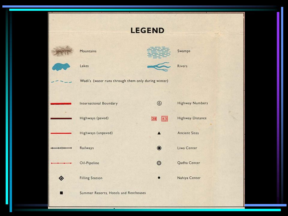
3) Rule 3: _________________ contour lines form V’s when they cross a river.
 Rule 3: _________________ contour lines form V’s when they cross a river.")
110
The “V” always points uphill to a higher elevation. This means that the if the river flows downhill, it MUST flow the opposite direction of the V.

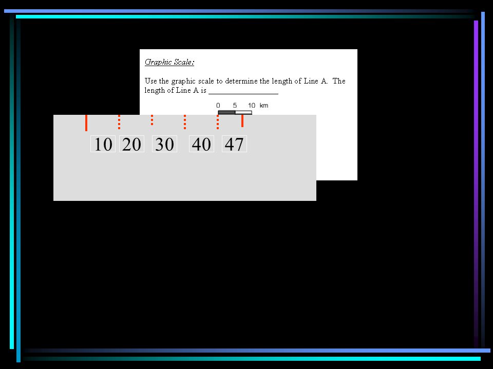
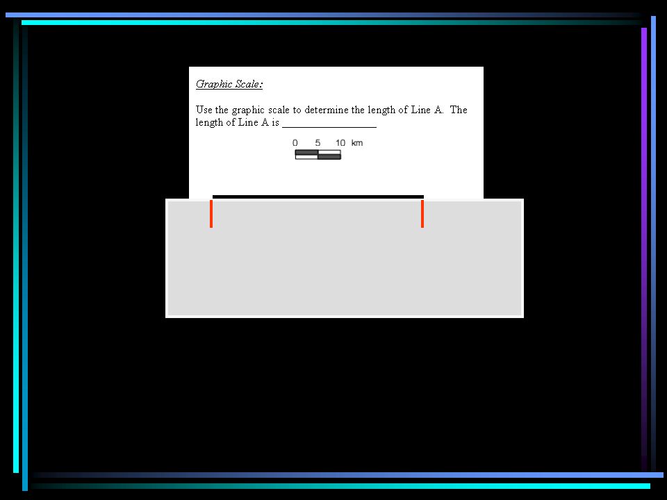
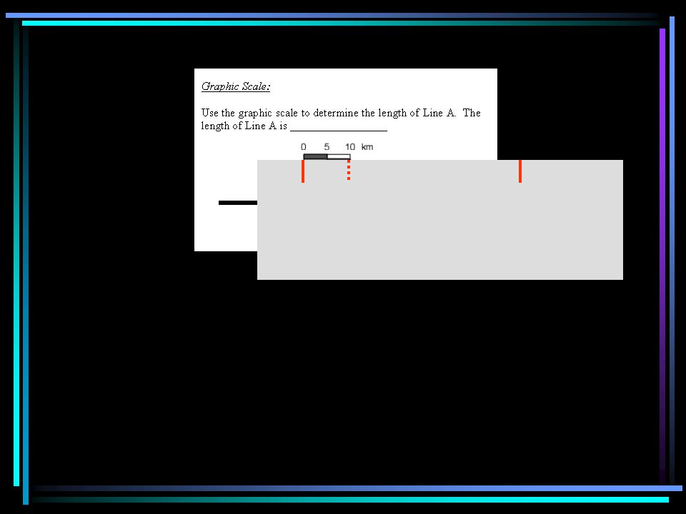
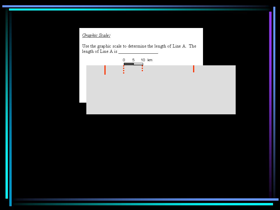
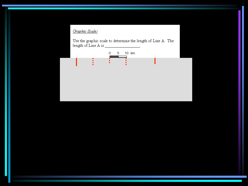
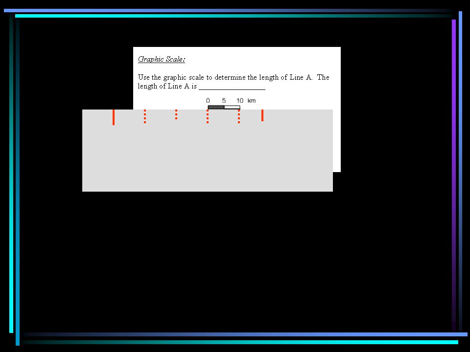
112
X = 110

113
Y=880

125
Map Information

126
A __________ or _______ tells the meaning of symbols on a map. legend or key

128
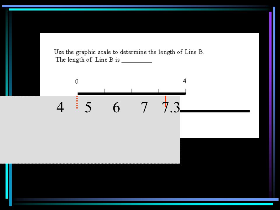
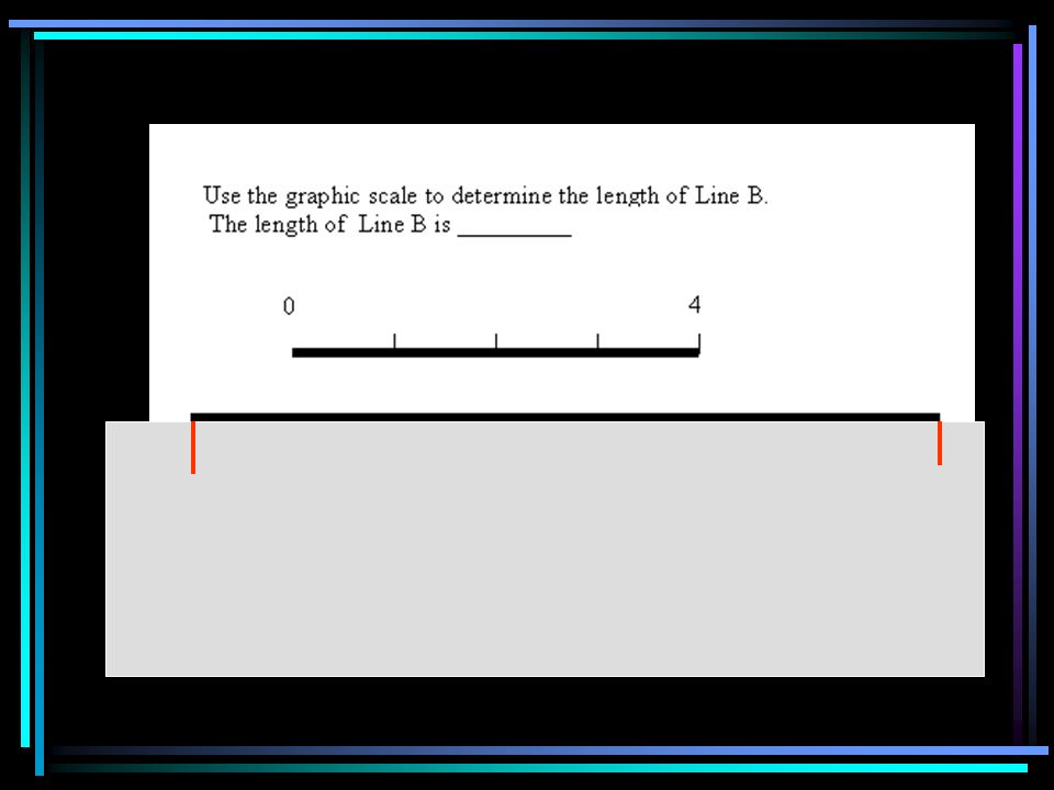
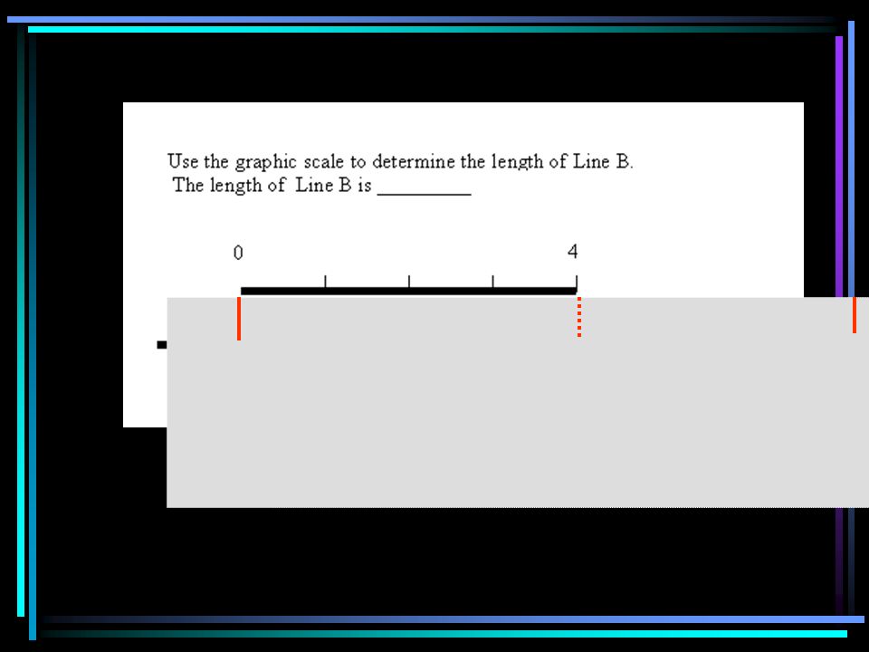
The relationship between map distance and actual distances is shown by a ____. scale

129
Types of scales

130
Use the graphic scale to determine the length of line A.

137
1020304047
138
The length of Line A is _______. 47 kilometers

139
Use the graphic scale to determine the length of line B.

142
46577.3
143
Line B is ______ 7.3 miles.

144
Verbal Scale: 1” = 1 mile means ______________. 1 inch on map = one mile on land

145
What is the length of line C? 1” = 2000’

146
3.5 inches x 2000 feet/inch = 7000 feet

147
Line C is ________ 7000 feet.

148
What is the length of line D? 1 cm = 2000 feet

149
12.3 cm x 2000 feet/cm = 24,600 feet.

150
Line D is ________ 24,600 feet.

151
If the representative fraction is 1:24000, - this means _____________ one unit of anything on map = 24000 of those units in actual distance

152
x y 1 inch

Similar presentations


.>")


