Download presentation
Presentation is loading. Please wait.

1
Field Drainage Technology LiDAR John Nowatzki Extension Ag Machine Systems Specialist

2
LiDAR Applications to Drainage LiDAR Technology and Applications What is Needed to use LiDAR? Online Viewing Tool Downloading LiDAR Data Viewing in Free Fugro Viewer GIS Software to Make Drainage Plan

3
LiDAR Technology Light Detection And Ranging Optical Remote Sensing using Lasers Measuring Distance to Ground from Airplane measures the time delay between transmission of a pulse and detection of the reflected signal

4
Agriculture Applications Flood Maps Tile and Surface Drainage Topographic Layer for Precision Agriculture Road Construction Community Development

5
What is Needed to use LiDAR? Computer Storage Space – 100 Megabytes per Square Mile Bare Earth Data – LAS File Format - LASer GIS Program Fugro Viewer – Free – Quick Elevation Model Commercial GIS Software Programs – Usable for Drainage Online Viewer - http://gis.rrbdin.org/lidarviewer/index.html

6
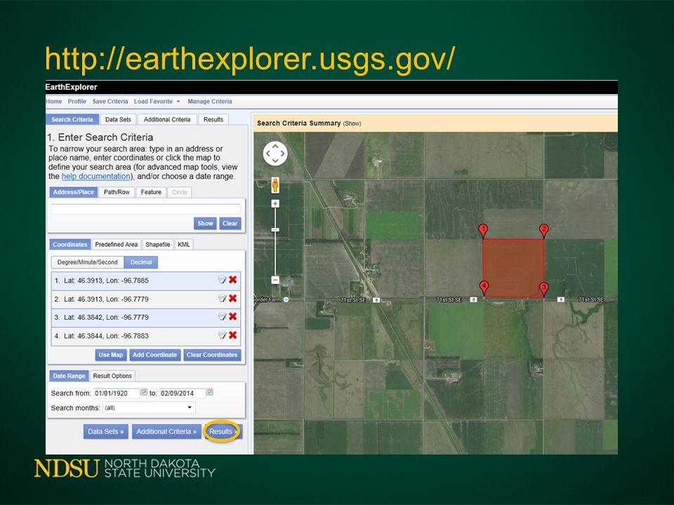
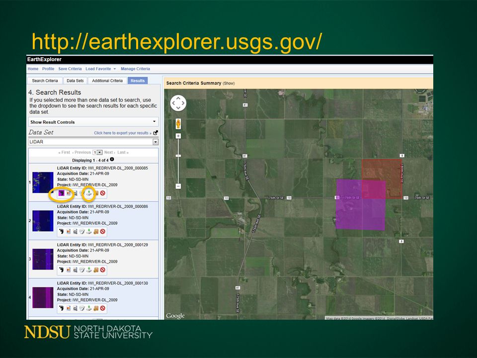
Downloading LiDAR Data USGS (US Geologic Survey – South Dakota http://earthexplorer.usgs.gov/ ND Water Commission – James River http://lidar.swc.nd.gov/ International Water Institute – Red River http://gis.rrbdin.org/lidardownload/index.html

7
International Water Institute LiDAR Viewer http://gis.rrbdin.org/lidarviewer/

8
International Water Institute Viewer

9
Downloading LiDAR Data www.internationalwaterinstitute.org/lidar.htm

10
Downloading LiDAR Data www.internationalwaterinstitute.org/lidar.htm

11
Downloading LiDAR Data www.internationalwaterinstitute.org/lidar.htm

12
Downloading LiDAR Data www.internationalwaterinstitute.org/lidar.htm

13
Downloading LiDAR Data Email Message Downloaded Files Extracted Contours Extracted LiDAR LASer (LAS) File Format 1 2 3
 File Format 1 2 3")
14
Downloading LiDAR Data USGS - US Geologic Survey http://earthexplorer.usgs.gov/

17
Downloading LiDAR Data USGS - US Geologic Survey http://lidar.cr.usgs.gov/

18
Minnesota LiDAR Data ftp://lidar.dnr.state.mn.us/

19
Minnesota ftp://lidar.dnr.state.mn.us/

20
Getting Started LiDAR Viewer Fugro Viewer GIS Software

21
Fugro Viewer http://www.internationalwaterinstitute.org/lidar.htm http://www.fugroviewer.com/

22
Fugro Viewer With Reference Layers

23
LiDAR Data in Fugro Viewer

24
3D View in Fugro Viewer

25
Fugro Viewer With Reference Layers

26
2.5 Square Miles – West Fargo

28
160 Acres – 65 Acres

29
2 meter Contours

30
1 meter Contours

31
0.3 meter Contours

32
0.1 meter Contours

33
0.81 meters 2.67 feet 32 inches

34
0.1 meter Contours 0.81 meters 2.67 feet 32 inches

35
You Need GIS Software to Prepare Drainage Plan Available from Area Consultants Consultants will Prepare Plans

36
ArcMAP GIS Software – with GeoCue Laser Reader http://www.geocue.com/support/utilities.html FREE utility adds las read capability to ArcGIS. Point x, y, z, intensity, return and classification values are read from the file and presented as a standard 3-D point data layer which can then be used as input to extensions such as 3-D Analyst.

37
ArcMAP GIS Software – Field in Central ND Aerial Image

38
ArcMAP GIS Software – Bare Earth LAS LAS to ArcGIS Point Shapefile

39
ArcMAP GIS Software – Elevation Model Meters Above Sea Level

40
Earth Point Townships in Google Earth http://www.earthpoint.us/Townships.aspx

41
Summary Light Detection And Ranging Need Computer and GIS Viewer to use LiDAR http://seamless.usgs.gov http://www.internationalwaterinstitute.org Need GIS Software to Prepare Drainage Plan

42
Questions - Comments Office 701-231-8213 Cell 701-261-9842 John.Nowatzki@ndsu.edu http://www.ag.ndsu.edu/agmachinery

Similar presentations


. The.>")


 mapping provided for the United States International Boundary and Water Commission (USIBWC) – established.>")


