Download presentation
Presentation is loading. Please wait.

1
U.S. Department of the Interior U.S. Geological Survey Projecting Global Raster Databases July 11, 2002 Joint International Symposium on GEOSPATIAL THEORY, PROCESSING AND APPLICATIONS, Ottawa, Canada

2
Projecting Global Raster Databases E. Lynn Usery usery@usgs.govusery@usgs.gov Michael P. Finn mfinn@usgs.govmfinn@usgs.gov Douglas Scheidt dscheidt@usgs.govdscheidt@usgs.gov U.S. Geological Survey 1400 Independence Road Rolla, Missouri 65401

3
Outline Motivation Objectives Approach Methods – Empirical Testing Results Conclusions

4
Motivation – What is the Problem? Projection of global databases with conventional GIS software results in error Errors affect global models and invalidate results

5
Objectives Develop an expert system to support map projection selection Develop a dynamic projection for raster data Determine an error correction model and methods to measure error and apply error correction Develop a better categorical resampler

6
Approach Empirical Testing Design and Implement a Decision Support System for map projection selection Compute exact areas in spherical coordinates and replicate cell-by-cell in projected data

7
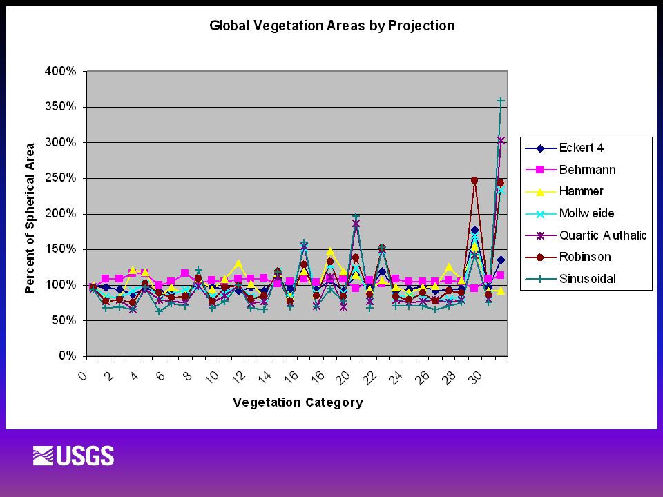
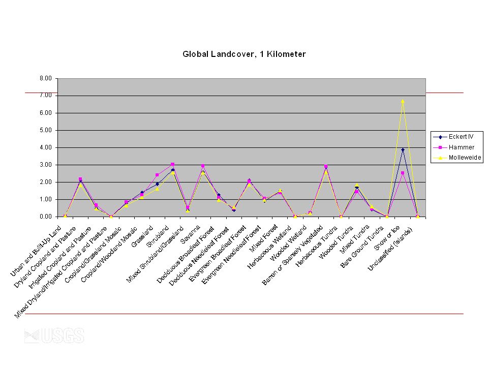
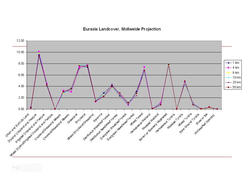
Empirical Testing Multiple Datasets Global land cover, 30 arc-sec Global elevation, 30 arc-sec Global population, 30 arc-sec Global temperature, ½ degree Global precipitation, ½ degree Global vegetation, 1 degree Down-sample 30 arc-sec data to 1,4,8,16,25,50 kilometers

8
Empirical Testing Multiple Projections – Primarily Equivalent Eckert IV Hammer Sinusoidal Mollweide Lambert Equal Area Cylindrical Wagner IV Robinson (non-equal area)
")
9
Empirical Test Results Use of Commercial GIS Software Commercial GIS software is unreliable for global projection; variety of problems Projections do not complete Work at some resamplings, but not others Inverse projections result is extension of raster areas to 0-degree lines Repeat areas at edges of projection Computation times extensive (100 to 200 hours on high end computers) May not use exact projection equations
 May not use exact projection equations")
10
Hammer from Commercial Software

11
Hammer from USGS Mapimg

12
Mollweide from Commercial Software

13
Mollweide from Mapimg

14
Sinusoidal from USGS Mapimg

15
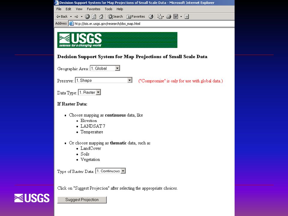
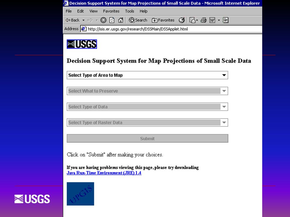
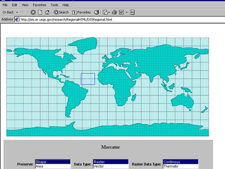
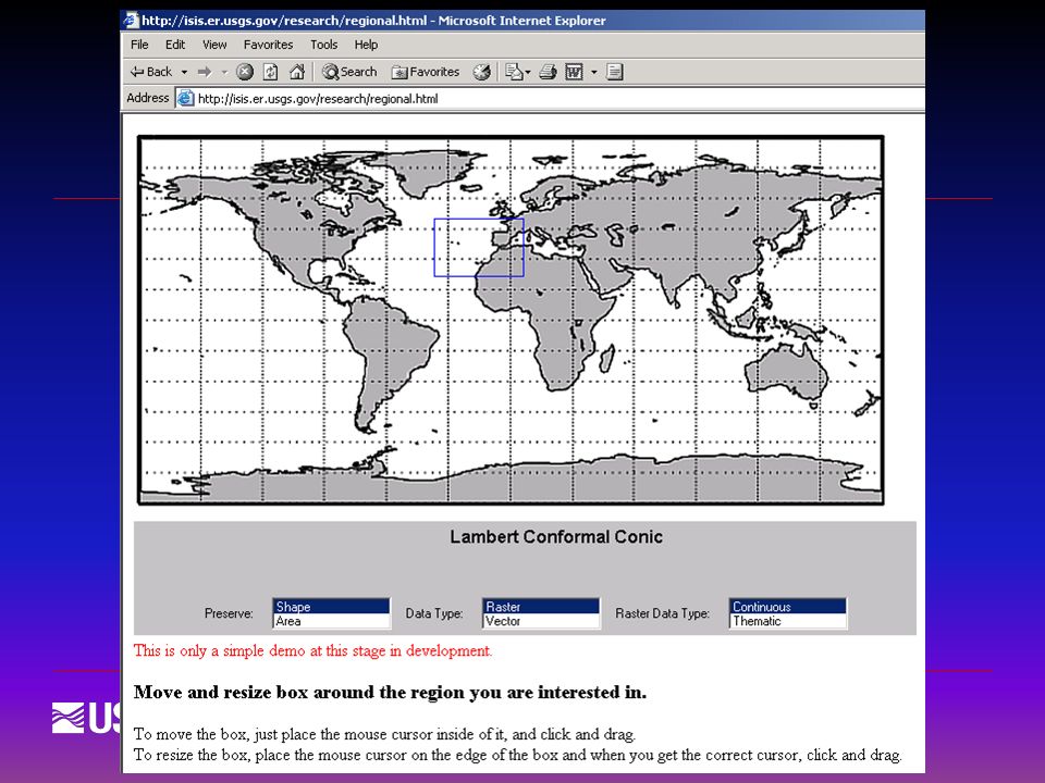
Decision Support System for Map Projection Selection Global, continental, regional (10 ° min) Preserve shape, area, compromise Data type – raster or vector If raster, continuous or discrete User input determines projection selection
 Preserve shape, area, compromise Data type – raster or vector If raster, continuous or discrete User input determines projection selection")
20
Dynamic Projection of Raster Cells Compute areas of pixels in geographic coordinates Map each raster line to appropriate area Result is accurate for computation and analysis, but each raster line has different size For 30 arcsec data, a cell at equator is approximately 1 km x 1 km, cell area = 1 km 2 Near poles, a cell is 1 km x 0.006 m, cell area = 6 m 2

21
Area Calculation for Equiangular Pixels in Spherical Coordinates

22
Latitude30 Arcsec0.5 Degree1.0 Degree 0 858,6313,091,035,69212,363,671,878 15 858,6312,982,220,44811,970,315,668 30 743,6282,670,171,82110,761,202,175 45 607,1882,176,155,4088,818,730,582 60 429,3701,533,837,6096,275,272,108 75 222,291786,991,3183,304,173,896 90 (-1 unit) 6313,487,417107,896,706 Pixel Areas Computed from Spherical Coordinates (in meters 2 )
 6313,487,417107,896,706 Pixel Areas Computed from Spherical Coordinates (in meters 2 )")
26
Conclusions Projection of global raster data is a significant problem Commercial GIS software is not reliable for global projection Users need guidance and software that works correctly for raster data

27
Conclusions A Decision Support System is needed and now available Area preservation in raster data is possible for computation and analysis, not for display

28
U.S. Department of the Interior U.S. Geological Survey Projecting Global Raster Databases July 11, 2002 Joint International Symposium on GEOSPATIAL THEORY, PROCESSING AND APPLICATIONS, Ottawa, Canada

Similar presentations