Download presentation
Presentation is loading. Please wait.

1
WHIPS Wisconsin Horizontal Interpolation Program for Satellites http://www.sage.wisc.edu/download/WHIPS/WHIPS.html As a command-line tool usable in either Linux or Unix environments WHIPS was developed by Jacob Oberman, Erica Scotty, Keith Maki and Tracey Holloway, with funding from the NASA Air Quality Applied Science Team (AQAST) and the Wisconsin Space Grant Consortium Undergraduate Award.
 and the Wisconsin Space Grant Consortium Undergraduate Award.")
2
Output is provided in the netCDF format. Output is flexible in resolution and projection Can be used to Validate models or compare ground based measurements against satellite measurements Need to compare multiple satellites on a common grid Currently, WHIPS can process the following data products: OMI NO2 (NASA retrieval) OMI NO2 (KNMI retrieval) MOPITT CO (NASA retrieval) MODIS AOD (NASA retrieval) WHIPS Wisconsin Horizontal Interpolation Program for Satellites
 OMI NO2 (KNMI retrieval) MOPITT CO (NASA retrieval) MODIS AOD (NASA retrieval) WHIPS Wisconsin Horizontal Interpolation Program for Satellites.")
3
Credit: Tracy Halloway and Jacob Oberman, http://www.ladco.org/about/general/2014%20Midwest%20Air%20Quality%20Workshop/Presentations_files/F_Trans_Sourc_Apptmt/Holloway_ St_Louis.pdf

4
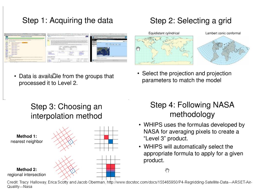
Credit: Tracy Halloway, Erica Scotty and Jacob Oberman, http://www.docstoc.com/docs/155465950/P4-Regridding-Satellite-Data---ARSET-Air- Quality---Nasa

6
Credit: Tracy Halloway, http://www.ladco.org/about/general/2014%20Midwest%20Air%20Quality%20Workshop/Presentations_files/F_Trans_Sourc_Apptmt/Holloway_ St_Louis.pdf

Similar presentations